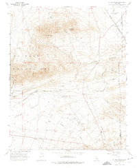
1967 Map of El Paso Peaks
USGS Topo · Published 1974About this map
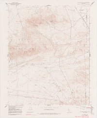
The El Paso Mountains and Summit Range dominate the northern landscape of this Mojave Desert survey, where deep drainages like Goler Gulch and Fiddler Gulch cut through the high terrain toward the Fremont Valley. The region reflects a significant mining and industrial history, evidenced by the Yellow Astor Mill (Ruins) and various gravel pits near Rand. Mining-era infrastructure is well-documented, with the Southern Pacific railroad skirting the southern slopes and an old railroad grade visible to the east near Searles. Settlement is sparse, clustered at points like Goler Heights and Garden City Station, or at remote water sources such as Haggin Well and Rinaldi Well. The presence of the Garlock Road and numerous tracks, including the Randsburg Road, suggests a network shaped by mineral extraction and the logistical needs of desert transit in the mid-1960s.
Find a feature on this map
32 named features on this map. Tap any name to fly to it.
Don’t see what you’re looking for? This feature index may not catch every label — zoom into the map to look around manually.
Map Details
Editions of this 1967 El Paso Peaks Map
5 editions found
Other maps of this area

1903 · Randsburg
USGS Topo · 1:62,500

1911 · Randsburg
USGS Topo · 1:62,500

1912 · Randsburg
USGS Topo · 1:62,500

1915 · Searles Lake
USGS Topo · 1:250,000

1943 · Inyokern
USGS Topo · 1:62,500

1943 · Saltdale
USGS Topo · 1:62,500

1947 · Trona
USGS Topo · 1:250,000

1948 · Trona
USGS Topo · 1:250,000

1953 · Ridgecrest
USGS Topo · 1:62,500

1953 · Trona
USGS Topo · 1:250,000