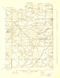
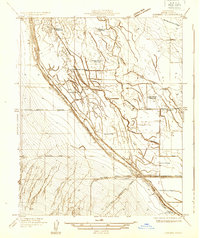
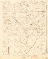
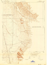
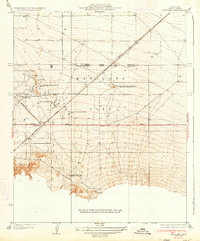
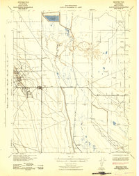
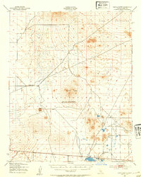
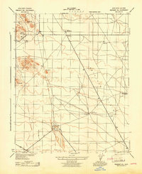
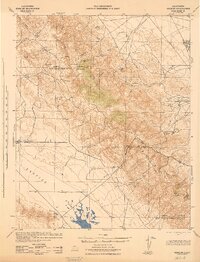
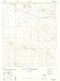
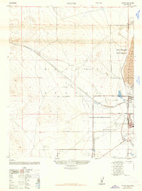
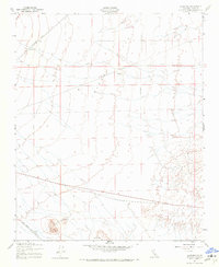
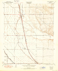
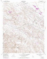
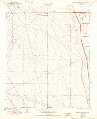
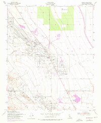
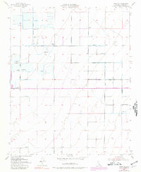
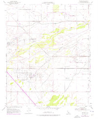
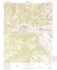
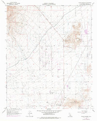
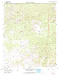
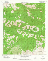
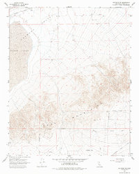
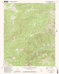
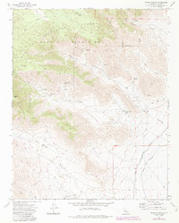
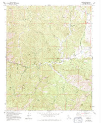
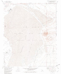
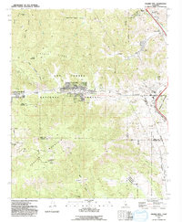
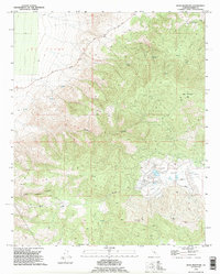
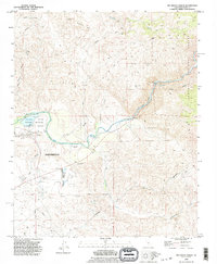
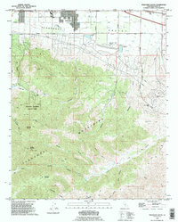
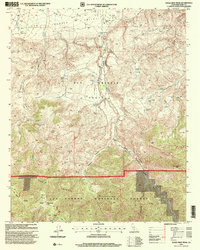
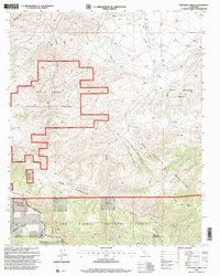
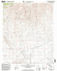
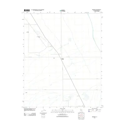
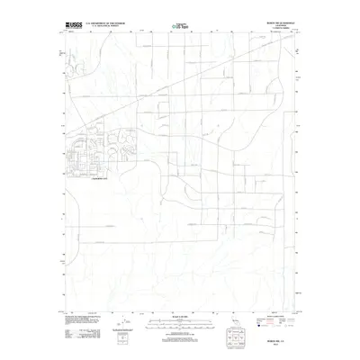
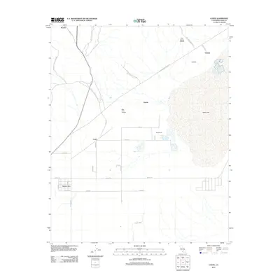
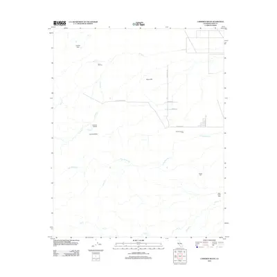
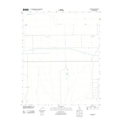
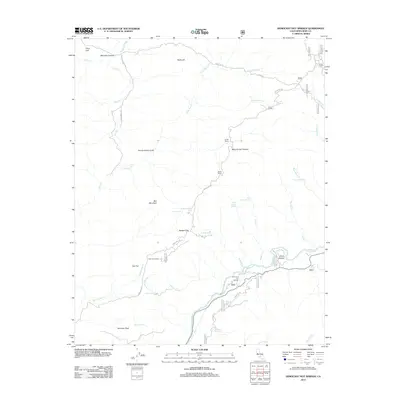
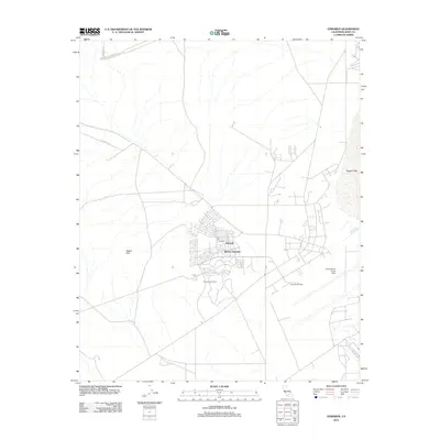
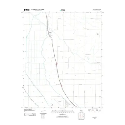
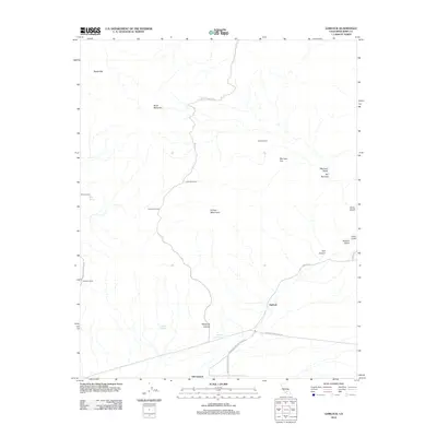
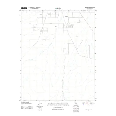
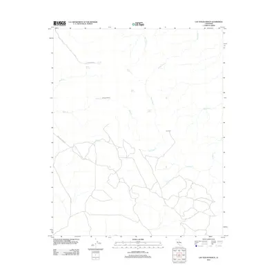
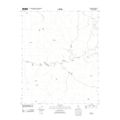
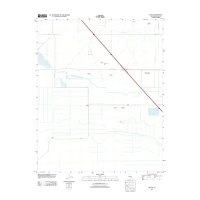
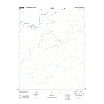
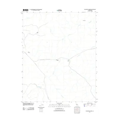
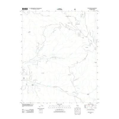
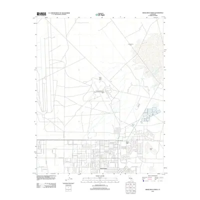
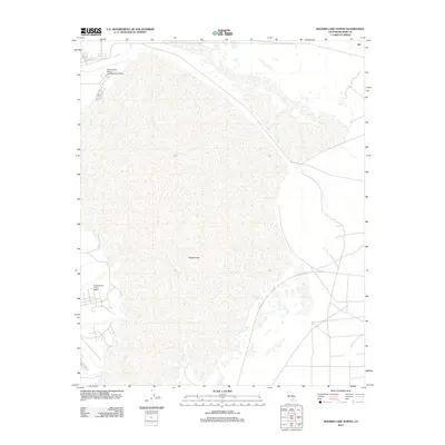
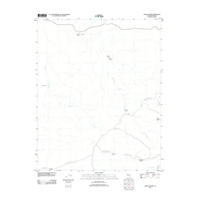
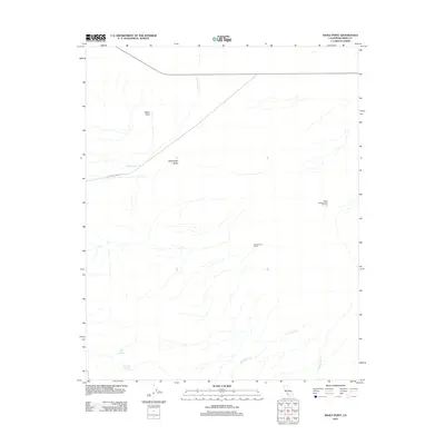
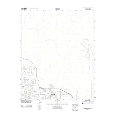
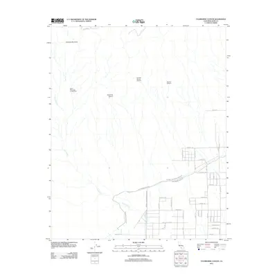
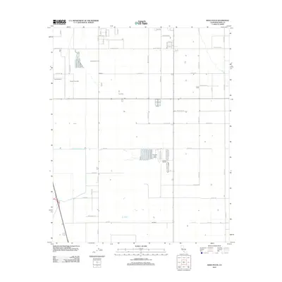
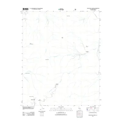
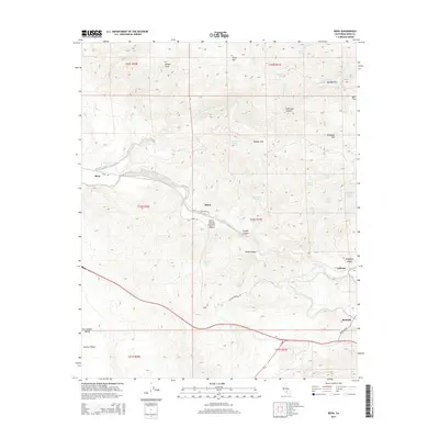
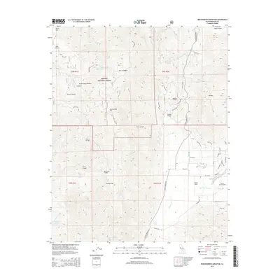
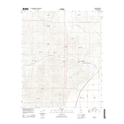
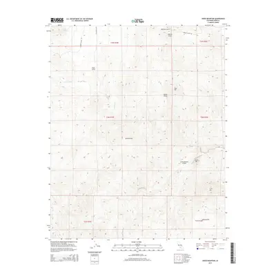
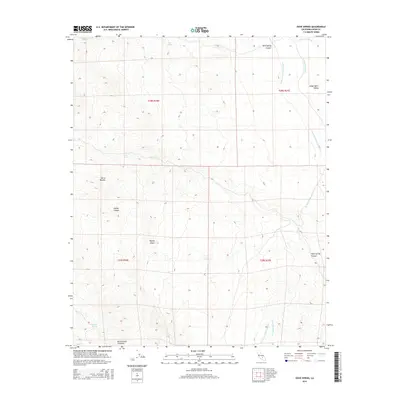
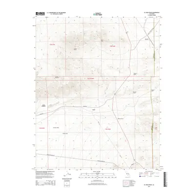
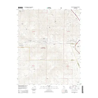
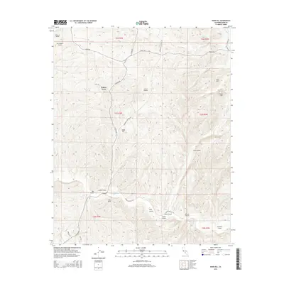
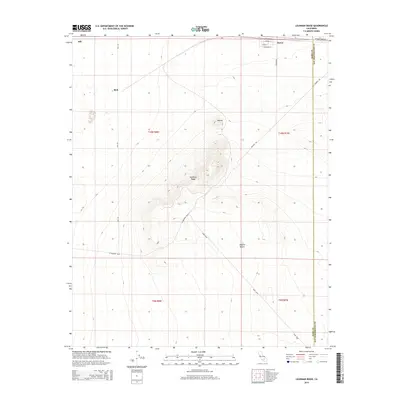
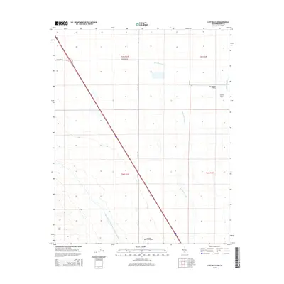
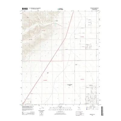
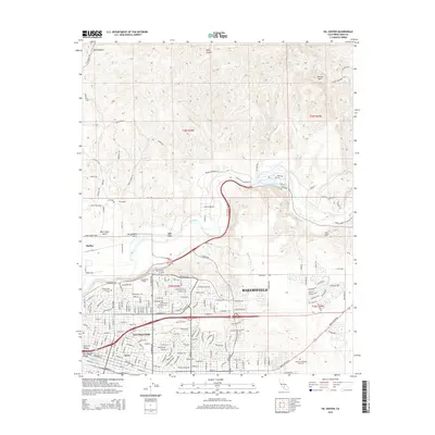
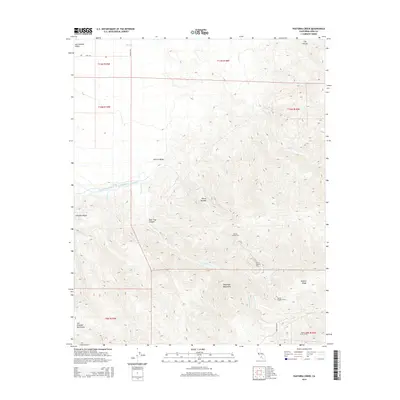
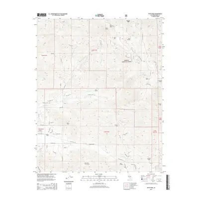
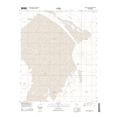
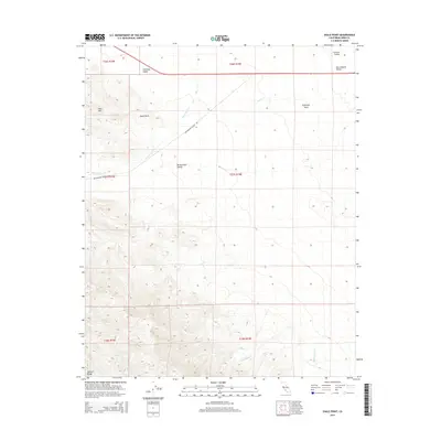
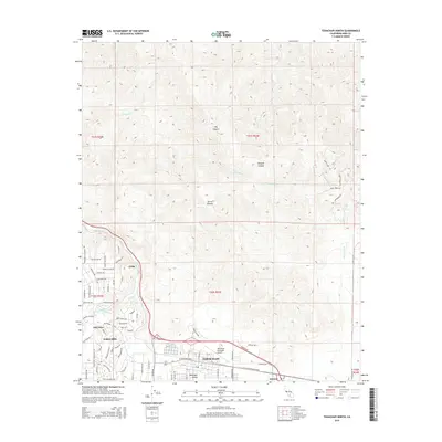
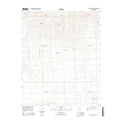
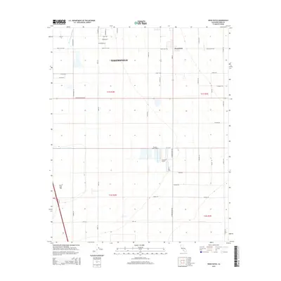
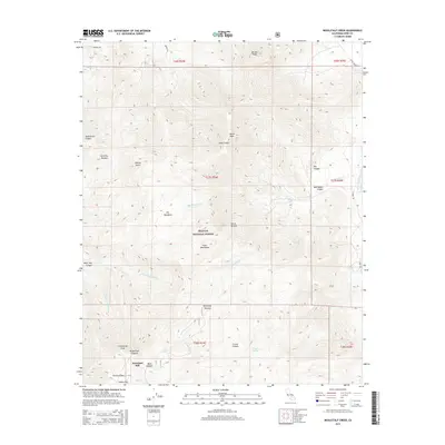
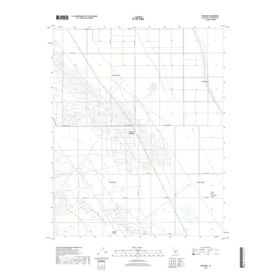
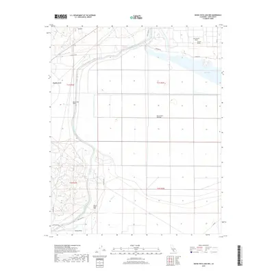
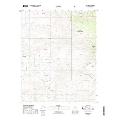
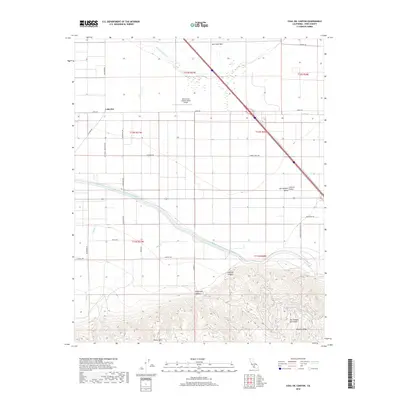
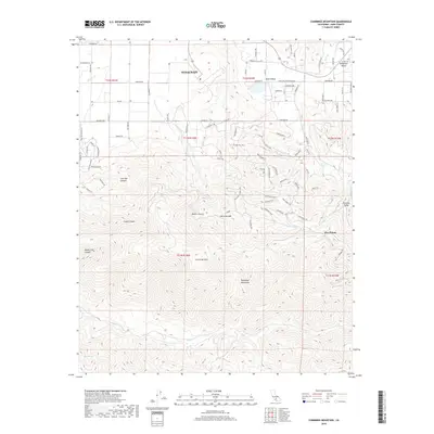
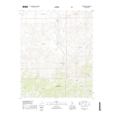
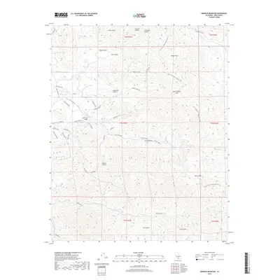
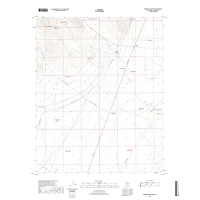
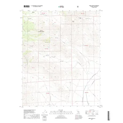
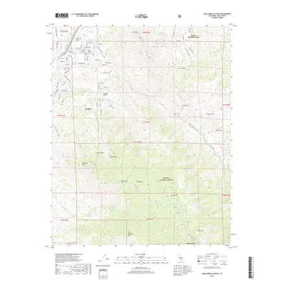
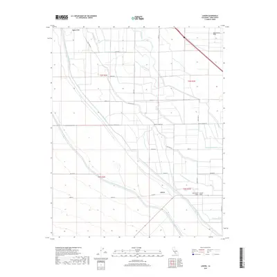
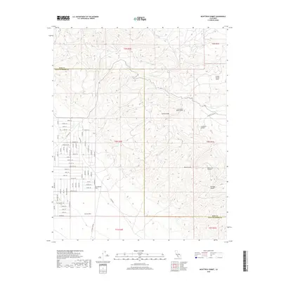
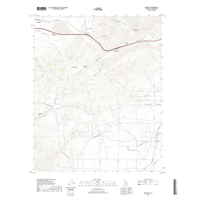
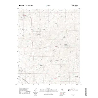
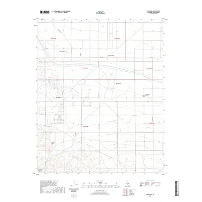
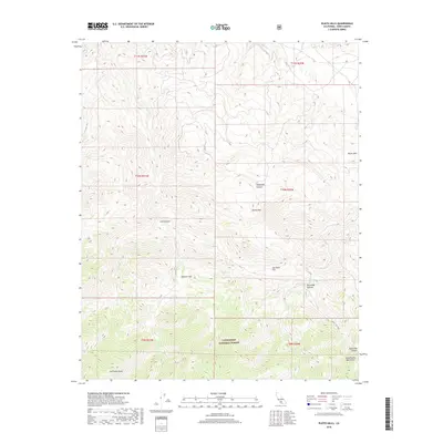
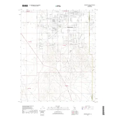
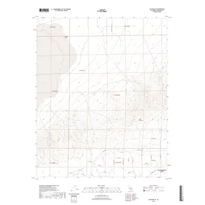
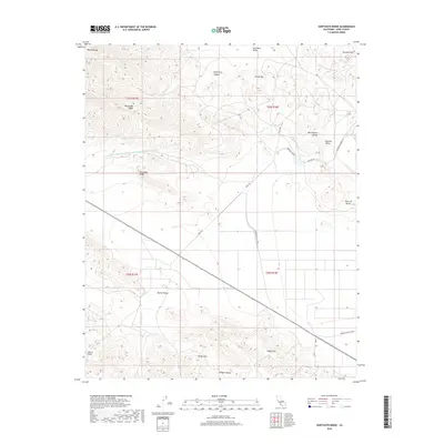
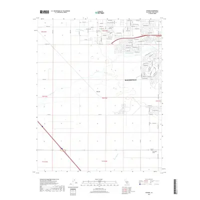
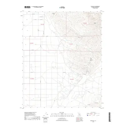
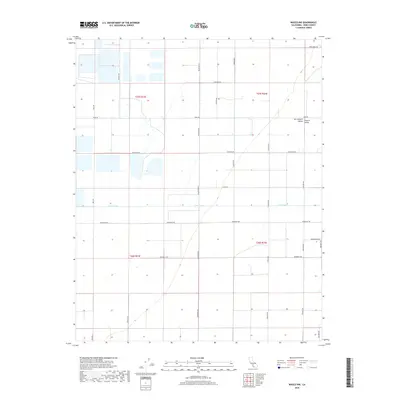
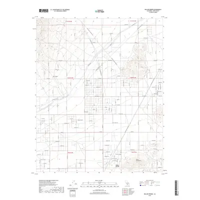
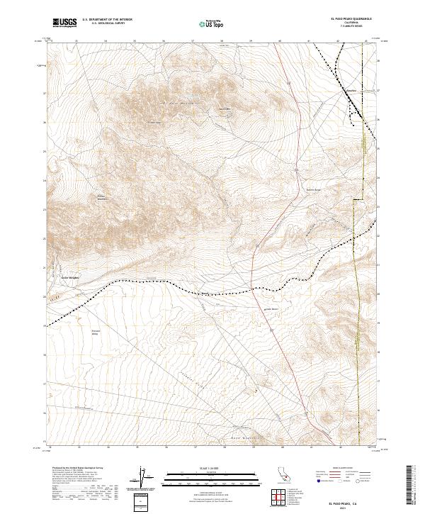
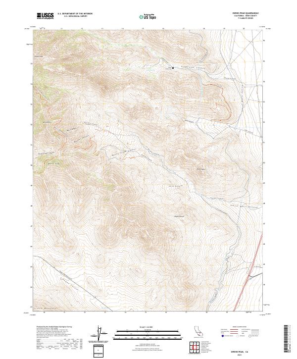
1967 Map of El Paso Peaks
USGS Topo · Published 1991About this map
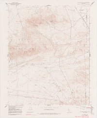
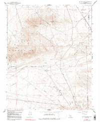
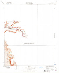
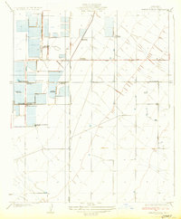
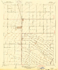
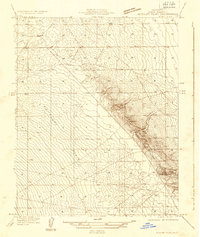
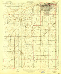
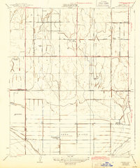
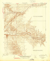
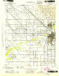
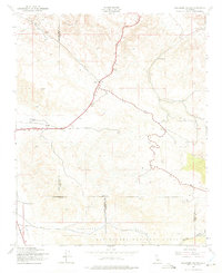
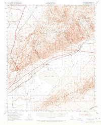
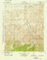
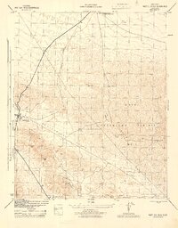
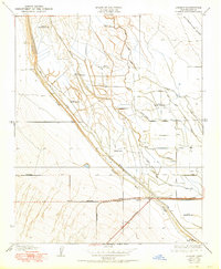
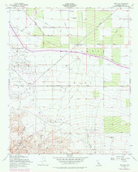
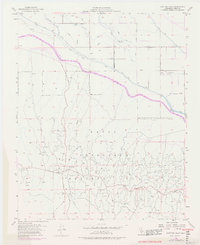
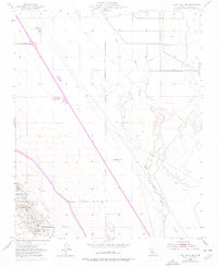
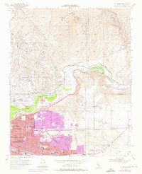
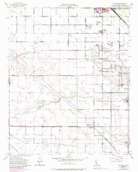
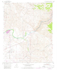
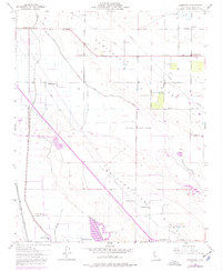
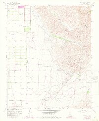
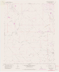
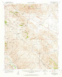
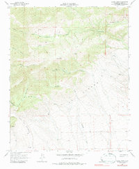
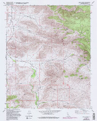
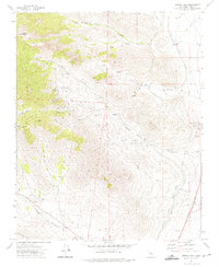
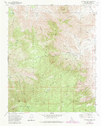
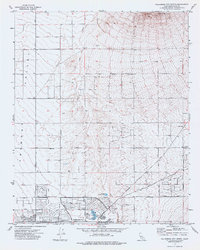
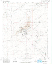
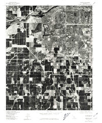
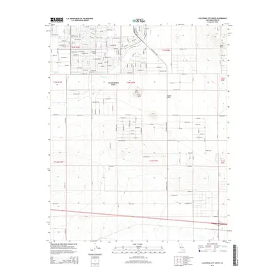
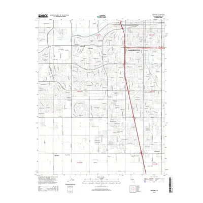
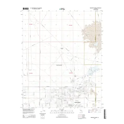
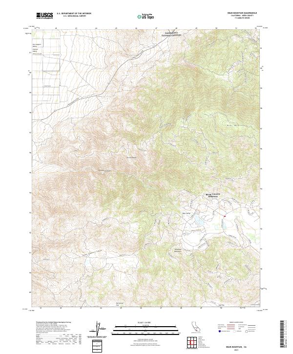
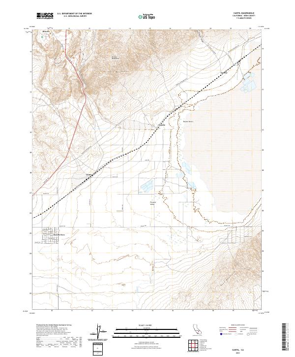
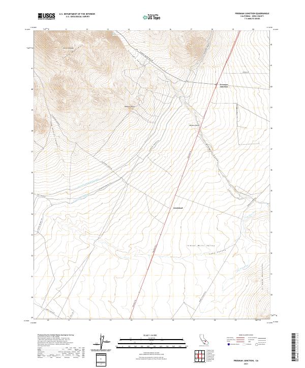
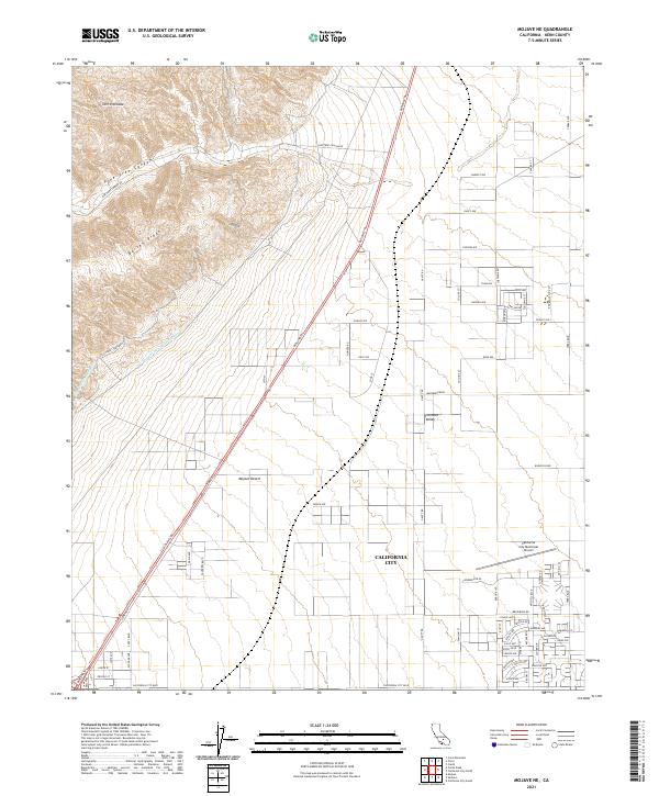
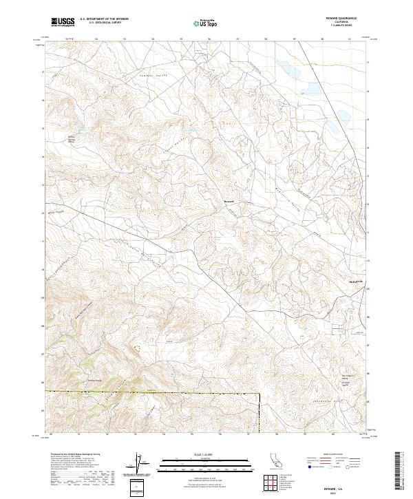
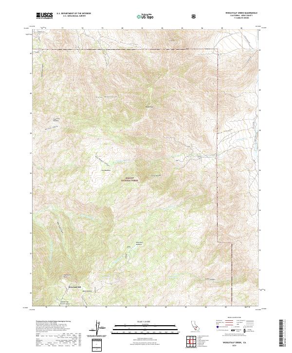
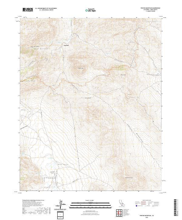
El Paso Mountains and the Summit Range dominate this desert landscape, where the high point of El Paso Peaks overlooks a complex network of canyons and dry washes. The 1960s terrain is marked by industrial and survival infrastructure essential to the high desert, including numerous water sources like Willow Spring Well and Haggin Well. To the north, the floor of Searles Valley meets the foothills, supporting the Garden City Station and the settlement of Searles. The presence of an Old Railroad Grade and several unnamed mines near Goler Gulch and Phoenix Gulch indicates a history of extraction that shaped the local geography. In the southern reaches, Fremont Valley opens up, traversed by established routes like Garlock Road and Randsburg Road, which connect isolated outposts like Goler Heights to the surrounding mining districts.
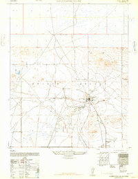
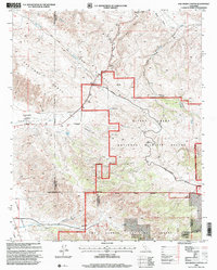
Find a feature on this map
32 named features on this map. Tap any name to fly to it.
Don’t see what you’re looking for? This feature index may not catch every label — zoom into the map to look around manually.
Map Details
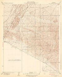
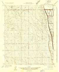
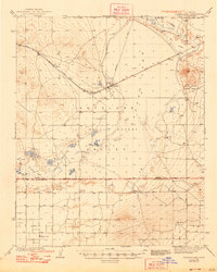
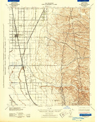
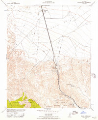
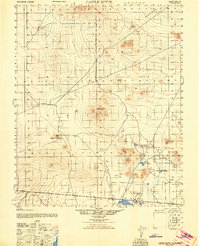
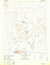
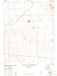
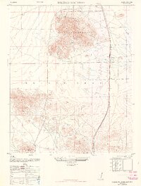
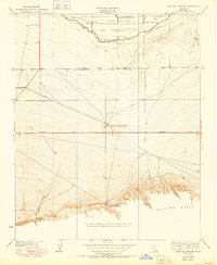
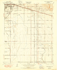
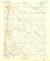
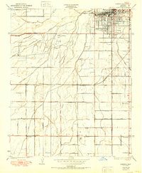
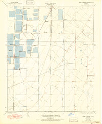
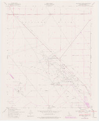
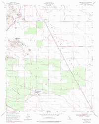
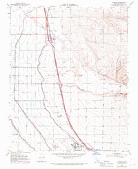
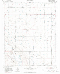
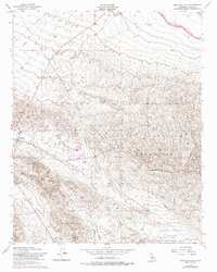
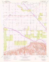
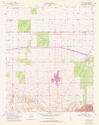
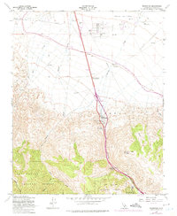
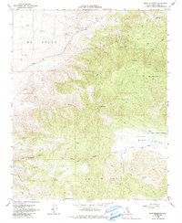
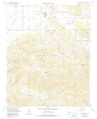
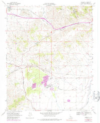
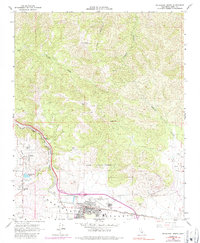
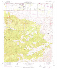
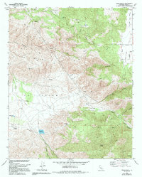
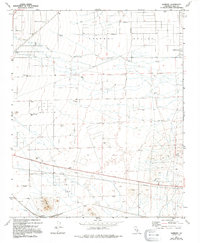
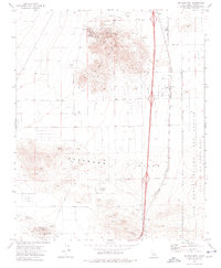
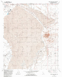
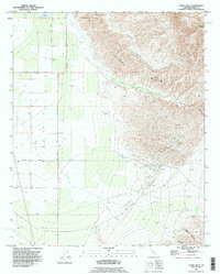
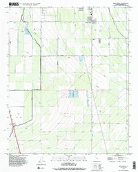
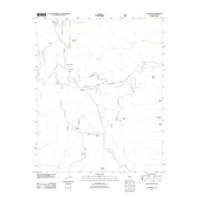
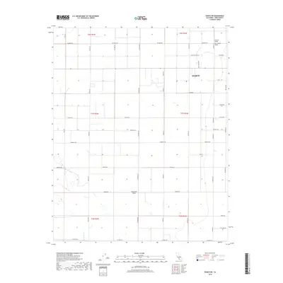
Editions of this 1967 El Paso Peaks Map
5 editions found
Historical Maps of Rand Through Time
645 maps found

1910 Buena Vista Lake
Kern County, CA
1912 Buena Vista Lake
Kern County, CA
1914 Caliente
Kern County, CA

1920 Delonagha
Kern County, CA
1927 Semitropic
Kern County, CA
1929 Bena
Kern County, CA
1929 Coles Levee
Kern County, CA
1929 Fairfax School
Kern County, CA
1929 Mouth of Kern
Kern County, CA
1929 Stevens
Kern County, CA
1930 Bear Mountain
Kern County, CA
1930 Conner
Kern County, CA
1930 Famoso
Kern County, CA
1930 Hamlin School
Kern County, CA
1930 Leonards
Kern County, CA
1930 Millux
Kern County, CA
1930 Miramonte Ranch
Kern County, CA
1930 Pond
Kern County, CA

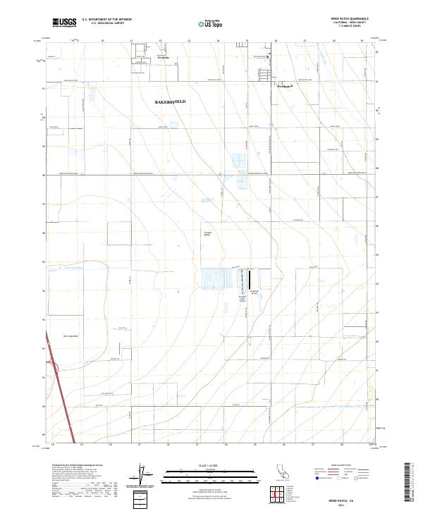
1930 Weed Patch
Kern County, CA
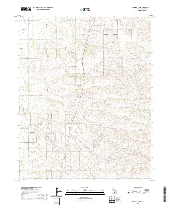
1931 Deepwell Ranch
Kern County, CA
1931 Goose Lake
Kern County, CA
1931 Hayes Ranch
Kern County, CA
1931 Lokern
Kern County, CA
1931 Pentland Junction
Kern County, CA
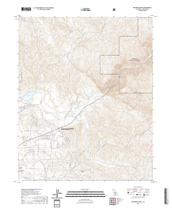
1931 Rio Bravo
Kern County, CA
1931 West of Tejon Hills
Kern County, CA
1932 Antelope Plain
Kern County, CA
1932 Bena
Kern County, CA
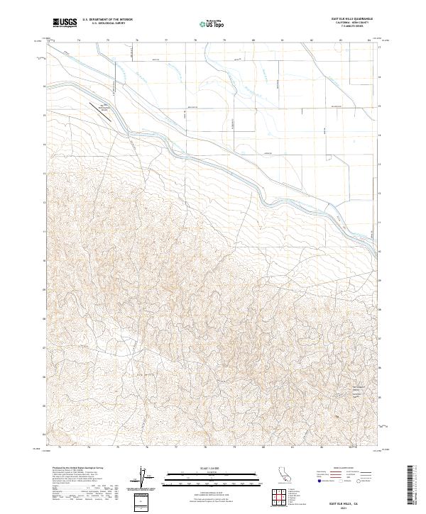
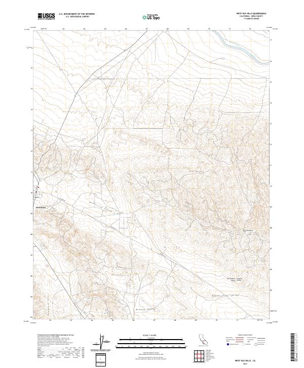
1932 East Elk Hills
Kern County, CA
1932 Fairfax School
Kern County, CA
1932 Gosford
Kern County, CA
1932 Mouth of Kern
Kern County, CA
1932 North of Oildale
Kern County, CA
1932 Reynolds Ranch
Kern County, CA
1932 Stevens
Kern County, CA
1932 West Elk Hills
Kern County, CA
1932 West of Goose Lake
Kern County, CA
1933 Bear Mountain
Kern County, CA
1933 Conner
Kern County, CA
1933 Hayes Ranch
Kern County, CA
1933 Millux
Kern County, CA
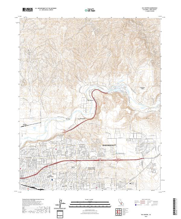
1933 Oil Center
Kern County, CA
1933 Tejon Hills
Kern County, CA
1933 Weed Patch
Kern County, CA
1934 Coal Oil Canyon
Kern County, CA
1934 Lokern
Kern County, CA
1934 Pentland
Kern County, CA
1934 West of Goose Lake
Kern County, CA
1934 West of Tejon Hills
Kern County, CA
1936 Antelope Plain
Kern County, CA
1936 North of Oildale
Kern County, CA

1936 Tobias Peak
Kern County, CA
1937 Rogers Lake
Kern County, CA
1940 Oil Center
Kern County, CA
1940 Reynolds Ranch
Kern County, CA
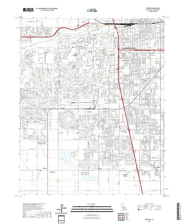
1942 Bakersfield West
Kern County, CA
1942 Ballinger Canyon
Kern County, CA
1942 Eagle Rest Peak
Kern County, CA
1942 Frazier Mountain
Kern County, CA
1942 Hart Station
Kern County, CA
1942 Rogers Lake
Kern County, CA
1942 Slater
Kern County, CA
1942 Tecuya Creek
Kern County, CA
1943 Ballinger Canyon
Kern County, CA
1943 Belridge
Kern County, CA
1943 Blackwell
Kern County, CA
1943 Breckenridge Mtn
Kern County, CA
1943 Castle Butte
Kern County, CA
1943 Cross Mountain
Kern County, CA
1943 Cummings Mountain
Kern County, CA
1943 Emerald Mtn
Kern County, CA
1943 Emigrant Hill
Kern County, CA
1943 Isabella Dam
Kern County, CA
1943 Neenach
Kern County, CA
1943 Packwood
Kern County, CA
1943 Saltdale
Kern County, CA
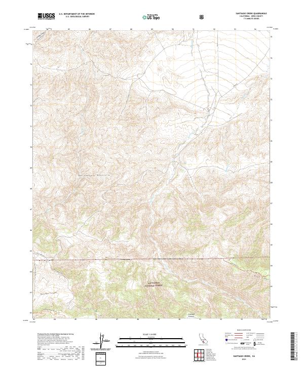
1943 Santiago Creek
Kern County, CA
1943 Sawtooth Ridge
Kern County, CA
1943 Shale Point
Kern County, CA
1943 Simmler
Kern County, CA
1943 Tobias Peak
Kern County, CA
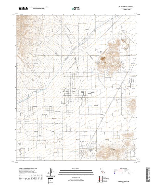
1943 Willow Springs
Kern County, CA
1944 Ballinger Canyon
Kern County, CA
1944 Eagle Rest Peak
Kern County, CA
1944 Frazier Mountain
Kern County, CA
1944 Mouth of Kern
Kern County, CA
1944 Pleito Hills
Kern County, CA
1944 West Elk Hills
Kern County, CA

1945 Pastoria Creek
Kern County, CA
1945 Pentland
Kern County, CA
1945 Santiago Creek
Kern County, CA
1945 Tecuya Creek
Kern County, CA
1947 Bissell
Kern County, CA
1947 Castle Butte
Kern County, CA
1947 Castle Butte SE
Kern County, CA
1947 Desert Butte
Kern County, CA
1947 Fluhr
Kern County, CA
1947 Johannesburg SW
Kern County, CA
1947 Muroc
Kern County, CA
1947 Rich
Kern County, CA
1947 Sanborn
Kern County, CA
1947 Soledad Mountain
Kern County, CA
1950 Coal Oil Canyon
Kern County, CA
1950 Fairfax School
Kern County, CA
1950 Famoso
Kern County, CA
1950 Goose Lake
Kern County, CA
1950 Gosford
Kern County, CA
1950 Hamlin School
Kern County, CA
1950 Lokern
Kern County, CA
1950 Mouth of Kern
Kern County, CA
1950 Oil Center
Kern County, CA
1950 Pentland
Kern County, CA
1950 Reward
Kern County, CA
1950 Reynolds Ranch
Kern County, CA
1950 Stevens
Kern County, CA
1950 West Elk Hills
Kern County, CA
1950 West of Goose Lake
Kern County, CA
1951 Mouth of Kern
Kern County, CA
1951 Reward
Kern County, CA
1952 Deepwell Ranch
Kern County, CA
1953 Belridge
Kern County, CA
1953 Blackwells Corner
Kern County, CA
1953 Emigrant Hill
Kern County, CA
1953 Famoso
Kern County, CA
1953 Pentland
Kern County, CA
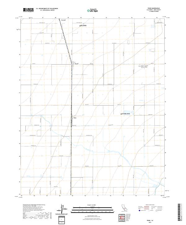
1953 Pond
Kern County, CA
1953 Sawtooth Ridge
Kern County, CA
1953 Shale Point
Kern County, CA
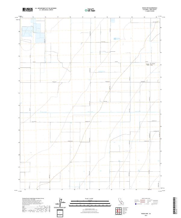
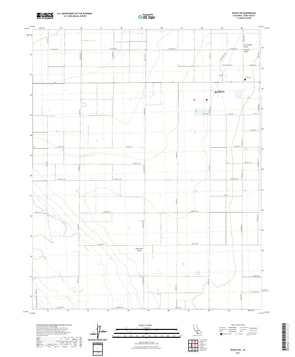
1953 Wasco NW
Kern County, CA
1953 Wasco SW
Kern County, CA
1954 Antelope Plain
Kern County, CA
1954 Conner
Kern County, CA
1954 East Elk Hills
Kern County, CA
1954 Gosford
Kern County, CA
1954 Lokern
Kern County, CA
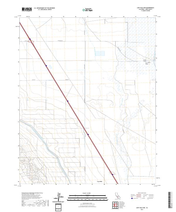
1954 Lost Hills NE
Kern County, CA
1954 Lost Hills NW
Kern County, CA
1954 Mc Farland
Kern County, CA
1954 Millux
Kern County, CA
1954 North of Oildale
Kern County, CA
1954 Oil Center
Kern County, CA
1954 Rio Bravo
Kern County, CA
1954 Rio Bravo Ranch
Kern County, CA
1954 Semitropic
Kern County, CA
1954 Stevens
Kern County, CA
1954 West Elk Hills
Kern County, CA
1955 Coal Oil Canyon
Kern County, CA
1955 Conner SW
Kern County, CA
1955 Tejon Hills
Kern County, CA
1955 Weed Patch
Kern County, CA
1956 Castle Butte
Kern County, CA
1956 Rogers Lake
Kern County, CA
1958 Frazier Mtn
Kern County, CA
1958 Grapevine
Kern County, CA
1958 Pastoria Creek
Kern County, CA
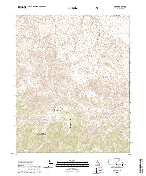
1958 Pleito Hills
Kern County, CA
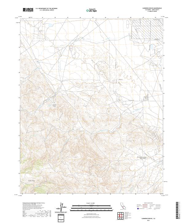
1959 Carneros Rocks
Kern County, CA
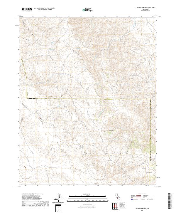
1959 Las Yeguas Ranch
Kern County, CA
1959 Mc Kittrick Summit
Kern County, CA
1959 Simmler
Kern County, CA
1961 Orchard Peak
Kern County, CA
1961 Packwood Creek
Kern County, CA
1961 Sawtooth Ridge
Kern County, CA
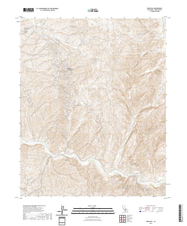
1965 Knob Hill
Kern County, CA
1965 Liebre Twins
Kern County, CA
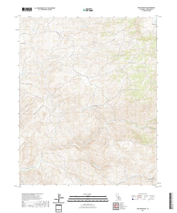
1965 Pine Mountain
Kern County, CA
1965 Sand Canyon
Kern County, CA
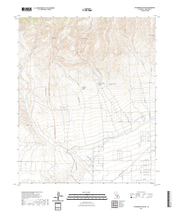
1965 Tylerhorse Canyon
Kern County, CA
1965 Willow Springs
Kern County, CA
1966 Bear Mountain
Kern County, CA
1966 Cummings Mtn
Kern County, CA
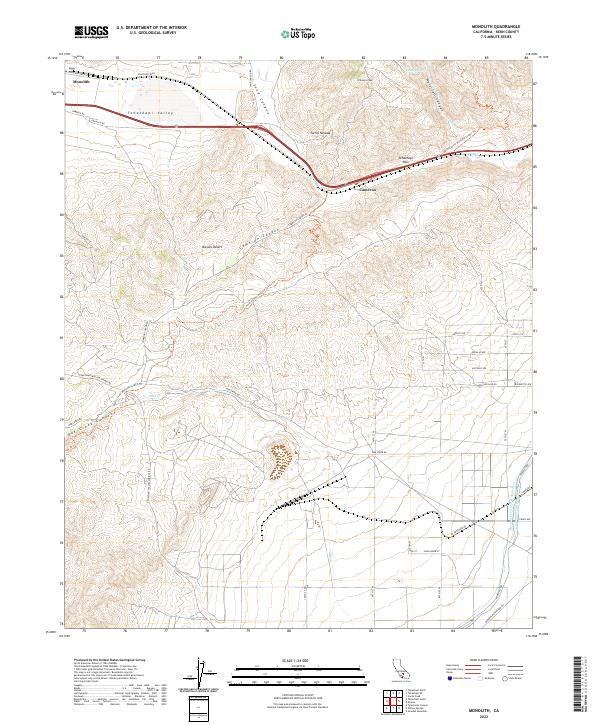
1966 Monolith
Kern County, CA
1966 Tehachapi NE
Kern County, CA
1966 Tehachapi North
Kern County, CA
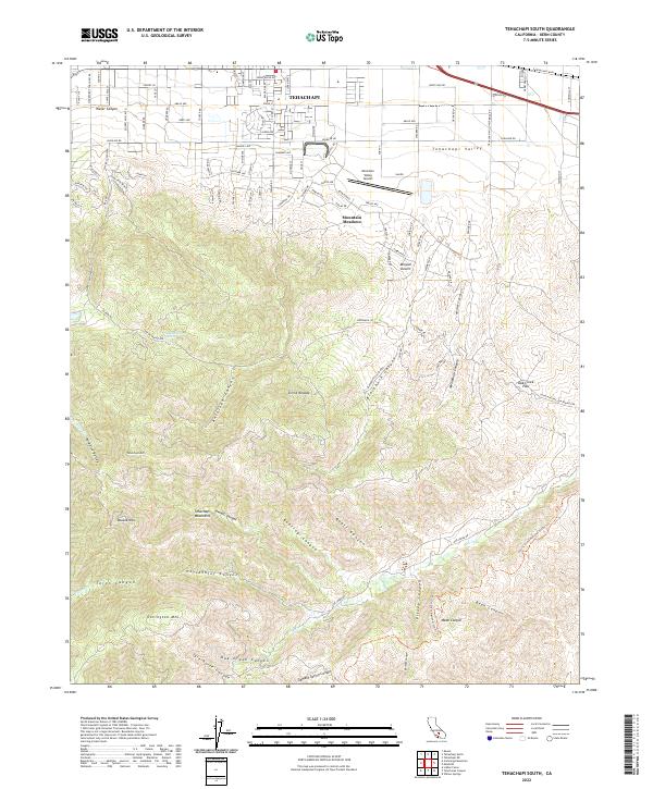
1966 Tehachapi South
Kern County, CA
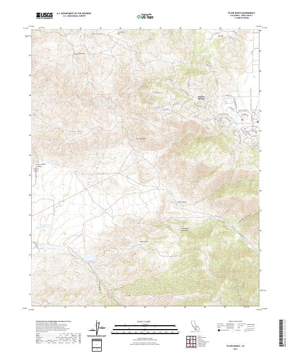
1966 Tejon Ranch
Kern County, CA
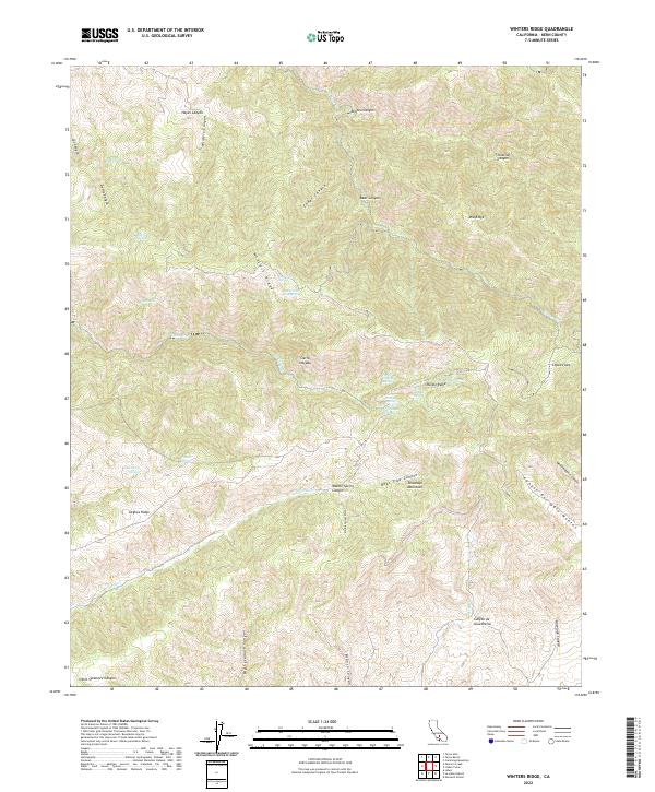
1966 Winters Ridge
Kern County, CA
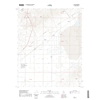
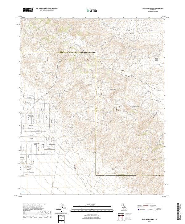
1967 Cantil
Kern County, CA
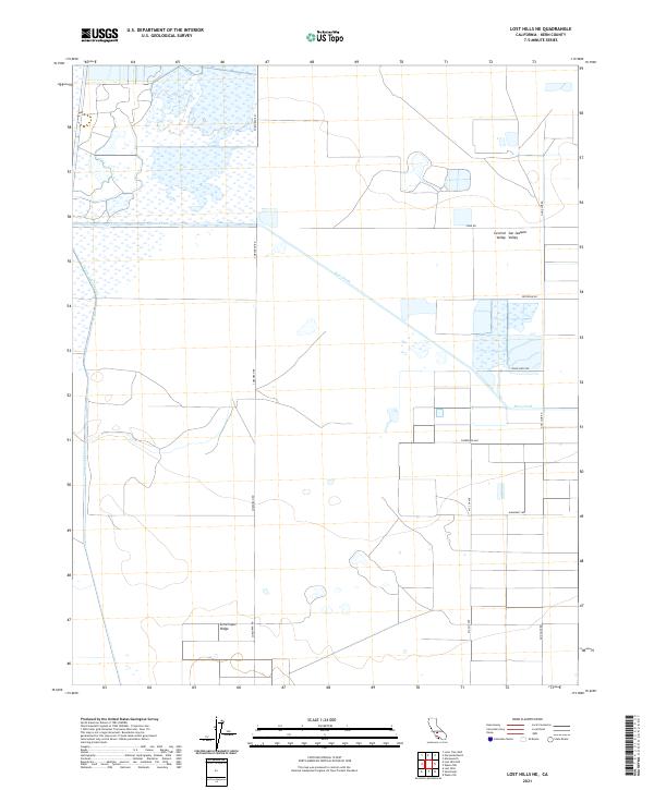
1967 El Paso Peaks
Kern County, CA
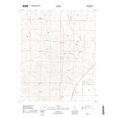
1967 Garlock
Kern County, CA
1967 Saltdale NW
Kern County, CA
1967 Saltdale SE
Kern County, CA
1968 Muroc
Kern County, CA
1972 Bena
Kern County, CA
1972 Breckenridge Mountain
Kern County, CA
1972 Cane Canyon
Kern County, CA
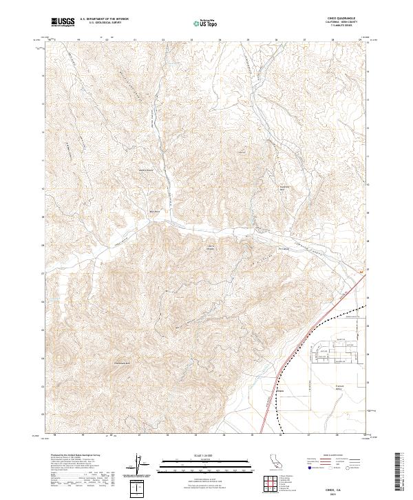
1972 Cinco
Kern County, CA
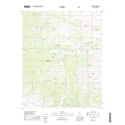
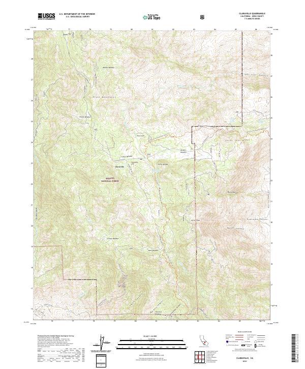
1972 Claraville
Kern County, CA
1972 Cross Mountain
Kern County, CA
1972 Democrat Hot Springs
Kern County, CA
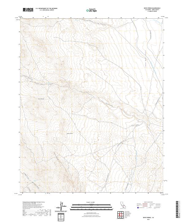
1972 Dove Spring
Kern County, CA
1972 Emerald Mountain
Kern County, CA
1972 Freeman Junction
Kern County, CA
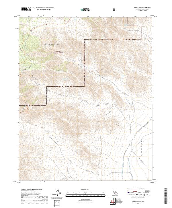
1972 Horse Canyon
Kern County, CA
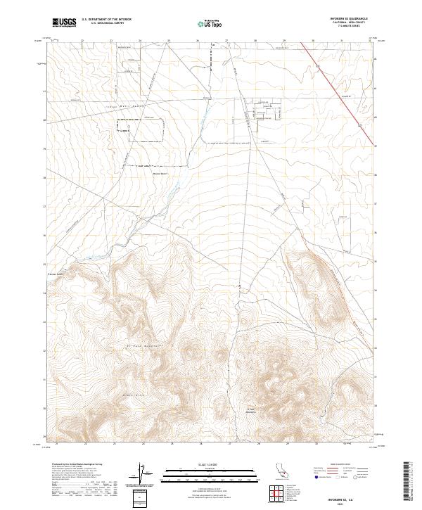
1972 Inyokern SE
Kern County, CA
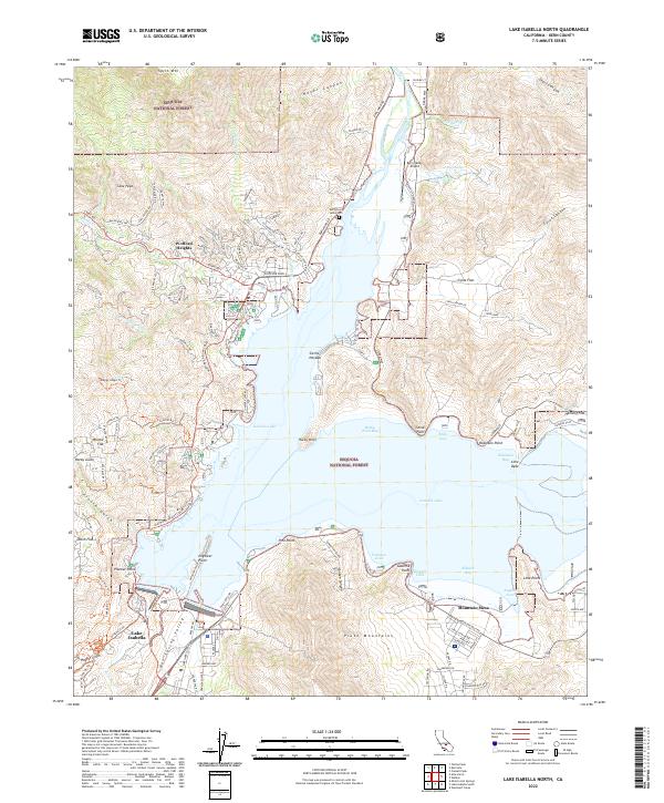
1972 Lake Isabella North
Kern County, CA
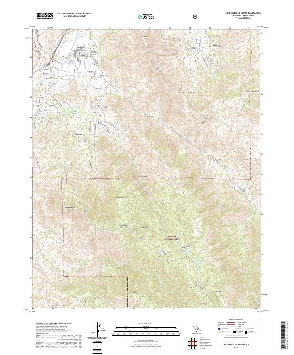
1972 Lake Isabella South
Kern County, CA
1972 Loraine
Kern County, CA
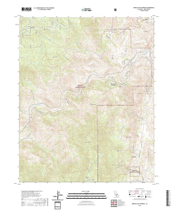
1972 Miracle Hot Springs
Kern County, CA
1972 Mt. Adelaide
Kern County, CA
1972 Oiler Peak
Kern County, CA
1972 Owens Peak
Kern County, CA
1972 Pinyon Mtn
Kern County, CA
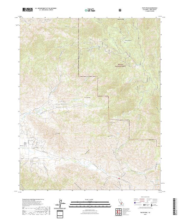
1972 Piute Peak
Kern County, CA
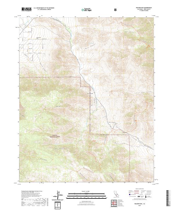
1972 Walker Pass
Kern County, CA
1972 Woolstalf Creek
Kern County, CA
1973 Bissell
Kern County, CA
1973 Boron NW
Kern County, CA
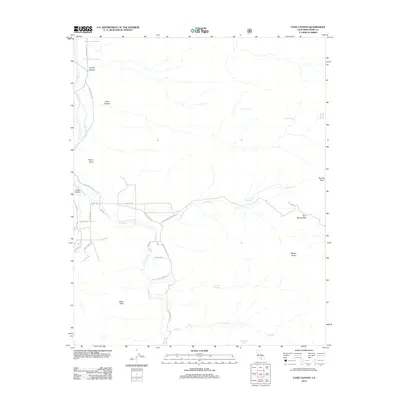
1973 Cache Peak
Kern County, CA
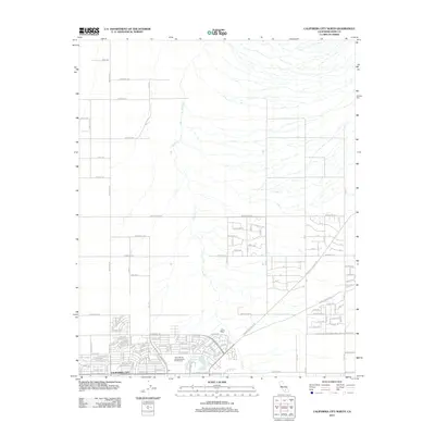
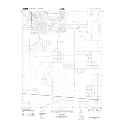
1973 California City North
Kern County, CA
1973 California City South
Kern County, CA
1973 Edwards
Kern County, CA
1973 Galileo Hill
Kern County, CA
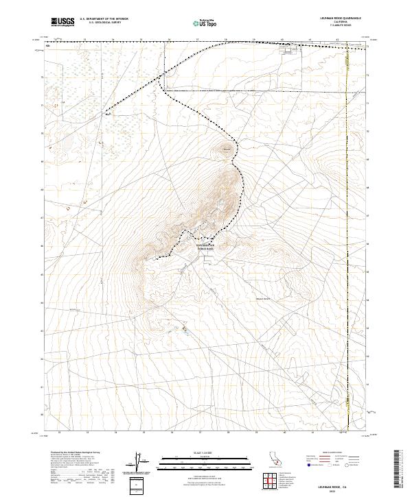
1973 Leuhman Ridge
Kern County, CA
1973 Mojave NE
Kern County, CA
1973 Ridgecrest North
Kern County, CA
1973 Ridgecrest South
Kern County, CA
1973 Rogers Lake North
Kern County, CA
1973 Sanborn
Kern County, CA
1973 Soledad Mtn
Kern County, CA
1977 Ballinger Canyon
Kern County, CA
1978 Gosford
Kern County, CA

1978 Isabella Lake
Kern County, CA
1978 Oil Center
Kern County, CA
1991 Ballinger Canyon
Kern County, CA
1991 Eagle Rest Peak
Kern County, CA
1991 Frazier Mtn
Kern County, CA
1991 Grapevine
Kern County, CA
1991 Pastoria Creek
Kern County, CA
1991 Pleito Hills
Kern County, CA

1991 Santiago Creek
Kern County, CA
1992 Bear Mountain
Kern County, CA
1992 Edwards
Kern County, CA
1992 Monolith
Kern County, CA
1992 Oil Center
Kern County, CA
1992 Rio Bravo Ranch
Kern County, CA
1992 Rogers Lake North
Kern County, CA
1992 Tehachapi NE
Kern County, CA
1992 Tehachapi North
Kern County, CA
1992 Tehachapi South
Kern County, CA
1992 Tejon Hills
Kern County, CA
1992 Weed Patch
Kern County, CA
1995 Ballinger Canyon
Kern County, CA
1995 Eagle Rest Peak
Kern County, CA
1995 Frazier Mountain
Kern County, CA
1995 Grapevine
Kern County, CA
1995 Pleito Hills
Kern County, CA
1995 Santiago Creek
Kern County, CA
1995 Tylerhorse Canyon
Kern County, CA
2012 Antelope Plain
Kern County, CA

2012 Ballinger Canyon
Kern County, CA
2012 Bear Mountain
Kern County, CA
2012 Belridge
Kern County, CA
2012 Bena
Kern County, CA
2012 Bissell
Kern County, CA
2012 Blackwells Corner
Kern County, CA
2012 Boron NW
Kern County, CA
2012 Breckenridge Mountain
Kern County, CA
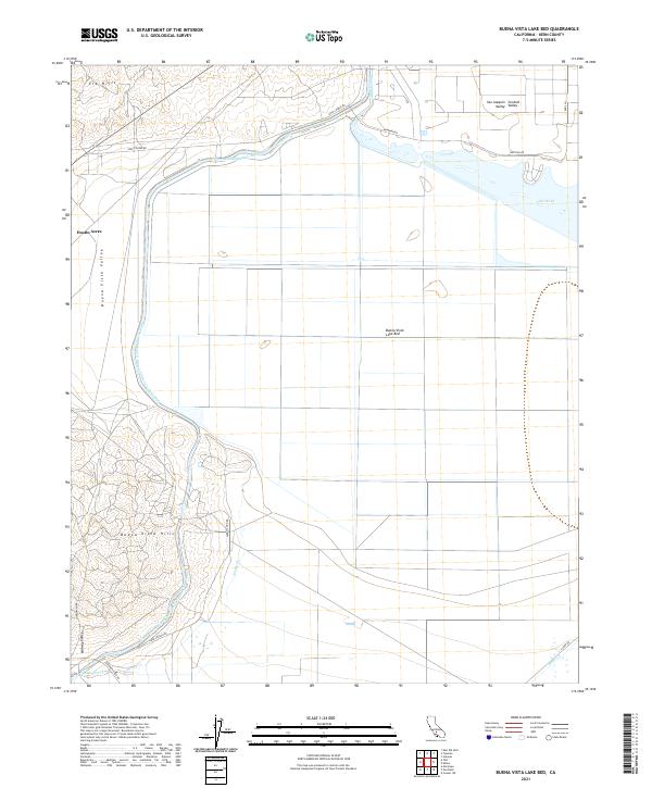
2012 Buena Vista Lake Bed
Kern County, CA
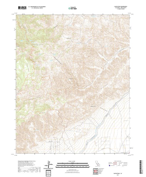
2012 Cache Peak
Kern County, CA
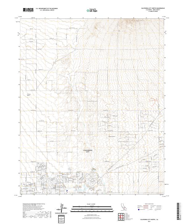
2012 California City North
Kern County, CA
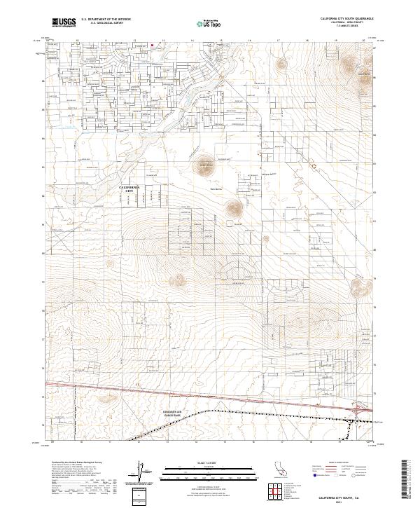
2012 California City South
Kern County, CA
2012 Cane Canyon
Kern County, CA
2012 Cantil
Kern County, CA
2012 Carneros Rocks
Kern County, CA

2012 Cinco
Kern County, CA
2012 Claraville
Kern County, CA
2012 Coal Oil Canyon
Kern County, CA
2012 Conner
Kern County, CA
2012 Conner SW
Kern County, CA
2012 Cross Mountain
Kern County, CA
2012 Cummings Mountain
Kern County, CA
2012 Deepwell Ranch
Kern County, CA
2012 Democrat Hot Springs
Kern County, CA
2012 Dove Spring
Kern County, CA
2012 Eagle Rest Peak
Kern County, CA
2012 East Elk Hills
Kern County, CA
2012 Edwards
Kern County, CA
2012 El Paso Peaks
Kern County, CA
2012 Emerald Mountain
Kern County, CA
2012 Emigrant Hill
Kern County, CA
2012 Famoso
Kern County, CA
2012 Frazier Mountain
Kern County, CA
2012 Freeman Junction
Kern County, CA
2012 Galileo Hill
Kern County, CA
2012 Garlock
Kern County, CA
2012 Gosford
Kern County, CA
2012 Grapevine
Kern County, CA
2012 Horse Canyon
Kern County, CA
2012 Inyokern SE
Kern County, CA
2012 Knob Hill
Kern County, CA
2012 Lake Isabella North
Kern County, CA
2012 Lake Isabella South
Kern County, CA
2012 Las Yeguas Ranch
Kern County, CA
2012 Leuhman Ridge
Kern County, CA
2012 Liebre Twins
Kern County, CA
2012 Lokern
Kern County, CA
2012 Loraine
Kern County, CA
2012 Lost Hills NE
Kern County, CA
2012 Lost Hills NW
Kern County, CA
2012 McKittrick Summit
Kern County, CA
2012 Millux
Kern County, CA
2012 Miracle Hot Springs
Kern County, CA
2012 Mojave NE
Kern County, CA
2012 Monolith
Kern County, CA
2012 Mount Adelaide
Kern County, CA
2012 North of Oildale
Kern County, CA
2012 Oil Center
Kern County, CA
2012 Oiler Peak
Kern County, CA

2012 Owens Peak
Kern County, CA
2012 Packwood Creek
Kern County, CA
2012 Pastoria Creek
Kern County, CA
2012 Pentland
Kern County, CA

2012 Pine Mountain
Kern County, CA
2012 Pinyon Mountain
Kern County, CA
2012 Piute Peak
Kern County, CA
2012 Pleito Hills
Kern County, CA
2012 Pond
Kern County, CA
2012 Reward
Kern County, CA
2012 Ridgecrest North
Kern County, CA
2012 Ridgecrest South
Kern County, CA
2012 Rio Bravo
Kern County, CA
2012 Rio Bravo Ranch
Kern County, CA
2012 Rogers Lake North
Kern County, CA
2012 Saltdale NW
Kern County, CA
2012 Saltdale SE
Kern County, CA
2012 Sanborn
Kern County, CA
2012 Sand Canyon
Kern County, CA
2012 Santiago Creek
Kern County, CA
2012 Sawtooth Ridge
Kern County, CA
2012 Semitropic
Kern County, CA
2012 Shale Point
Kern County, CA
2012 Soledad Mountain
Kern County, CA
2012 Stevens
Kern County, CA
2012 Tehachapi NE
Kern County, CA
2012 Tehachapi North
Kern County, CA
2012 Tehachapi South
Kern County, CA
2012 Tejon Hills
Kern County, CA
2012 Tejon Ranch
Kern County, CA
2012 Tylerhorse Canyon
Kern County, CA
2012 Walker Pass
Kern County, CA
2012 Wasco NW
Kern County, CA
2012 Wasco SW
Kern County, CA
2012 Weed Patch
Kern County, CA
2012 West Elk Hills
Kern County, CA
2012 Willow Springs
Kern County, CA
2012 Winters Ridge
Kern County, CA
2012 Woolstalf Creek
Kern County, CA
2015 Antelope Plain
Kern County, CA
2015 Ballinger Canyon
Kern County, CA
2015 Bear Mountain
Kern County, CA

2015 Belridge
Kern County, CA
2015 Bena
Kern County, CA
2015 Bissell
Kern County, CA
2015 Blackwells Corner
Kern County, CA
2015 Boron NW
Kern County, CA
2015 Breckenridge Mountain
Kern County, CA
2015 Buena Vista Lake Bed
Kern County, CA
2015 Cache Peak
Kern County, CA
2015 California City North
Kern County, CA
2015 California City South
Kern County, CA
2015 Cane Canyon
Kern County, CA
2015 Cantil
Kern County, CA
2015 Carneros Rocks
Kern County, CA
2015 Cinco
Kern County, CA

2015 Claraville
Kern County, CA
2015 Coal Oil Canyon
Kern County, CA
2015 Conner
Kern County, CA
2015 Conner SW
Kern County, CA
2015 Cross Mountain
Kern County, CA
2015 Cummings Mountain
Kern County, CA
2015 Deepwell Ranch
Kern County, CA
2015 Democrat Hot Springs
Kern County, CA
2015 Dove Spring
Kern County, CA
2015 Eagle Rest Peak
Kern County, CA
2015 East Elk Hills
Kern County, CA
2015 Edwards
Kern County, CA
2015 El Paso Peaks
Kern County, CA
2015 Emerald Mountain
Kern County, CA
2015 Emigrant Hill
Kern County, CA
2015 Famoso
Kern County, CA
2015 Frazier Mountain
Kern County, CA
2015 Freeman Junction
Kern County, CA
2015 Galileo Hill
Kern County, CA
2015 Garlock
Kern County, CA
2015 Gosford
Kern County, CA
2015 Grapevine
Kern County, CA
2015 Horse Canyon
Kern County, CA
2015 Inyokern SE
Kern County, CA
2015 Knob Hill
Kern County, CA
2015 Lake Isabella North
Kern County, CA
2015 Lake Isabella South
Kern County, CA
2015 Las Yeguas Ranch
Kern County, CA
2015 Leuhman Ridge
Kern County, CA
2015 Liebre Twins
Kern County, CA
2015 Lokern
Kern County, CA

2015 Loraine
Kern County, CA
2015 Lost Hills NE
Kern County, CA
2015 Lost Hills NW
Kern County, CA
2015 McKittrick Summit
Kern County, CA
2015 Millux
Kern County, CA
2015 Miracle Hot Springs
Kern County, CA
2015 Mojave NE
Kern County, CA
2015 Monolith
Kern County, CA
2015 Mount Adelaide
Kern County, CA
2015 North of Oildale
Kern County, CA
2015 Oil Center
Kern County, CA
2015 Oiler Peak
Kern County, CA
2015 Owens Peak
Kern County, CA
2015 Packwood Creek
Kern County, CA
2015 Pastoria Creek
Kern County, CA
2015 Pentland
Kern County, CA
2015 Pine Mountain
Kern County, CA
2015 Pinyon Mountain
Kern County, CA
2015 Piute Peak
Kern County, CA
2015 Pleito Hills
Kern County, CA
2015 Pond
Kern County, CA
2015 Reward
Kern County, CA
2015 Ridgecrest North
Kern County, CA
2015 Ridgecrest South
Kern County, CA
2015 Rio Bravo
Kern County, CA
2015 Rio Bravo Ranch
Kern County, CA
2015 Rogers Lake North
Kern County, CA
2015 Saltdale NW
Kern County, CA
2015 Saltdale SE
Kern County, CA
2015 Sanborn
Kern County, CA
2015 Sand Canyon
Kern County, CA
2015 Santiago Creek
Kern County, CA
2015 Sawtooth Ridge
Kern County, CA
2015 Semitropic
Kern County, CA
2015 Shale Point
Kern County, CA
2015 Soledad Mountain
Kern County, CA
2015 Stevens
Kern County, CA
2015 Tehachapi NE
Kern County, CA
2015 Tehachapi North
Kern County, CA
2015 Tehachapi South
Kern County, CA
2015 Tejon Hills
Kern County, CA
2015 Tejon Ranch
Kern County, CA
2015 Tylerhorse Canyon
Kern County, CA
2015 Walker Pass
Kern County, CA
2015 Wasco NW
Kern County, CA
2015 Wasco SW
Kern County, CA
2015 Weed Patch
Kern County, CA
2015 West Elk Hills
Kern County, CA
2015 Willow Springs
Kern County, CA
2015 Winters Ridge
Kern County, CA
2015 Woolstalf Creek
Kern County, CA
2018 Antelope Plain
Kern County, CA
2018 Ballinger Canyon
Kern County, CA
2018 Bear Mountain
Kern County, CA
2018 Belridge
Kern County, CA
2018 Bena
Kern County, CA
2018 Bissell
Kern County, CA

2018 Blackwells Corner
Kern County, CA

2018 Boron NW
Kern County, CA
2018 Breckenridge Mountain
Kern County, CA
2018 Buena Vista Lake Bed
Kern County, CA
2018 Cache Peak
Kern County, CA
2018 California City North
Kern County, CA
2018 California City South
Kern County, CA
2018 Cane Canyon
Kern County, CA
2018 Cantil
Kern County, CA

2018 Carneros Rocks
Kern County, CA
2018 Cinco
Kern County, CA
2018 Claraville
Kern County, CA
2018 Coal Oil Canyon
Kern County, CA
2018 Conner
Kern County, CA
2018 Conner SW
Kern County, CA
2018 Cross Mountain
Kern County, CA
2018 Cummings Mountain
Kern County, CA
2018 Deepwell Ranch
Kern County, CA
2018 Democrat Hot Springs
Kern County, CA
2018 Dove Spring
Kern County, CA
2018 Eagle Rest Peak
Kern County, CA
2018 East Elk Hills
Kern County, CA
2018 Edwards
Kern County, CA
2018 El Paso Peaks
Kern County, CA
2018 Emerald Mountain
Kern County, CA
2018 Emigrant Hill
Kern County, CA
2018 Famoso
Kern County, CA
2018 Frazier Mountain
Kern County, CA
2018 Freeman Junction
Kern County, CA
2018 Galileo Hill
Kern County, CA
2018 Garlock
Kern County, CA
2018 Gosford
Kern County, CA

2018 Grapevine
Kern County, CA
2018 Horse Canyon
Kern County, CA
2018 Inyokern SE
Kern County, CA
2018 Knob Hill
Kern County, CA
2018 Lake Isabella North
Kern County, CA
2018 Lake Isabella South
Kern County, CA
2018 Las Yeguas Ranch
Kern County, CA
2018 Leuhman Ridge
Kern County, CA
2018 Liebre Twins
Kern County, CA
2018 Lokern
Kern County, CA
2018 Loraine
Kern County, CA
2018 Lost Hills NE
Kern County, CA
2018 Lost Hills NW
Kern County, CA
2018 McKittrick Summit
Kern County, CA
2018 Millux
Kern County, CA
2018 Miracle Hot Springs
Kern County, CA
2018 Mojave NE
Kern County, CA
2018 Monolith
Kern County, CA
2018 Mount Adelaide
Kern County, CA
2018 North of Oildale
Kern County, CA
2018 Oil Center
Kern County, CA
2018 Oiler Peak
Kern County, CA
2018 Owens Peak
Kern County, CA
2018 Packwood Creek
Kern County, CA
2018 Pastoria Creek
Kern County, CA
2018 Pentland
Kern County, CA
2018 Pine Mountain
Kern County, CA
2018 Pinyon Mountain
Kern County, CA
2018 Piute Peak
Kern County, CA
2018 Pleito Hills
Kern County, CA
2018 Pond
Kern County, CA
2018 Reward
Kern County, CA
2018 Ridgecrest North
Kern County, CA
2018 Ridgecrest South
Kern County, CA

2018 Rio Bravo
Kern County, CA
2018 Rio Bravo Ranch
Kern County, CA
2018 Rogers Lake North
Kern County, CA
2018 Saltdale NW
Kern County, CA
2018 Saltdale SE
Kern County, CA
2018 Sanborn
Kern County, CA
2018 Sand Canyon
Kern County, CA
2018 Santiago Creek
Kern County, CA
2018 Sawtooth Ridge
Kern County, CA
2018 Semitropic
Kern County, CA
2018 Shale Point
Kern County, CA
2018 Soledad Mountain
Kern County, CA
2018 Stevens
Kern County, CA
2018 Tehachapi NE
Kern County, CA
2018 Tehachapi North
Kern County, CA
2018 Tehachapi South
Kern County, CA
2018 Tejon Hills
Kern County, CA
2018 Tejon Ranch
Kern County, CA
2018 Tylerhorse Canyon
Kern County, CA
2018 Walker Pass
Kern County, CA
2018 Wasco NW
Kern County, CA
2018 Wasco SW
Kern County, CA
2018 Weed Patch
Kern County, CA
2018 West Elk Hills
Kern County, CA
2018 Willow Springs
Kern County, CA
2018 Winters Ridge
Kern County, CA
2018 Woolstalf Creek
Kern County, CA
2021 Antelope Plain
Kern County, CA
2021 Bear Mountain
Kern County, CA
2021 Belridge
Kern County, CA
2021 Blackwells Corner
Kern County, CA
2021 Boron NW
Kern County, CA
2021 Buena Vista Lake Bed
Kern County, CA
2021 Cache Peak
Kern County, CA
2021 California City North
Kern County, CA
2021 California City South
Kern County, CA
2021 Cantil
Kern County, CA
2021 Carneros Rocks
Kern County, CA
2021 Cinco
Kern County, CA
2021 Claraville
Kern County, CA
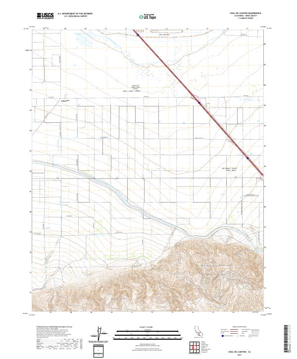
2021 Coal Oil Canyon
Kern County, CA
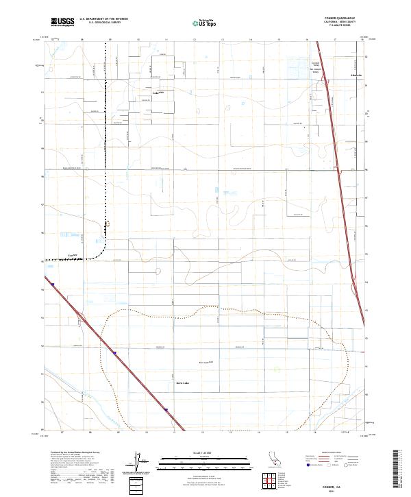
2021 Conner
Kern County, CA
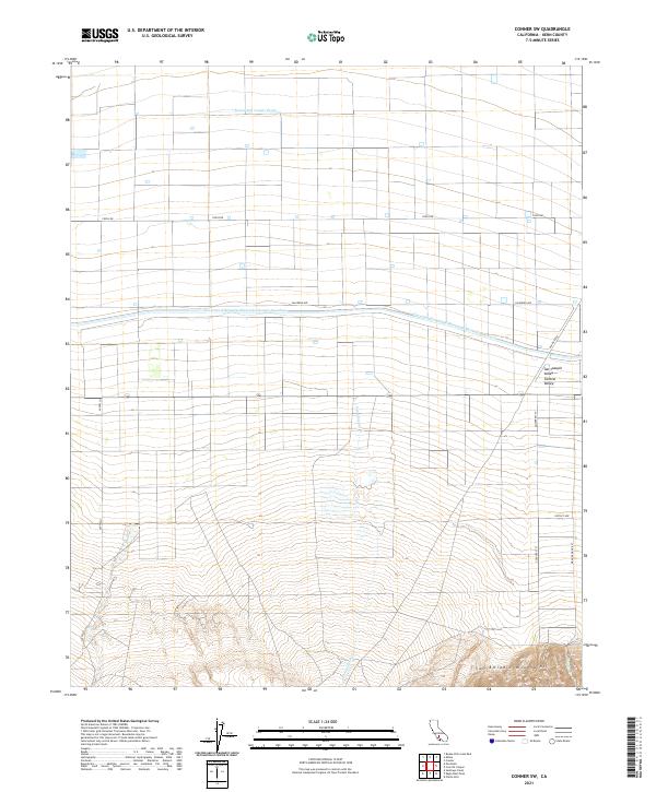
2021 Conner SW
Kern County, CA
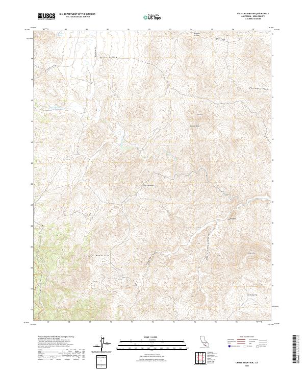
2021 Cross Mountain
Kern County, CA
2021 Cummings Mountain
Kern County, CA
2021 Deepwell Ranch
Kern County, CA
2021 Dove Spring
Kern County, CA
2021 East Elk Hills
Kern County, CA
2021 El Paso Peaks
Kern County, CA
2021 Emerald Mountain
Kern County, CA
2021 Emigrant Hill
Kern County, CA
2021 Famoso
Kern County, CA
2021 Freeman Junction
Kern County, CA
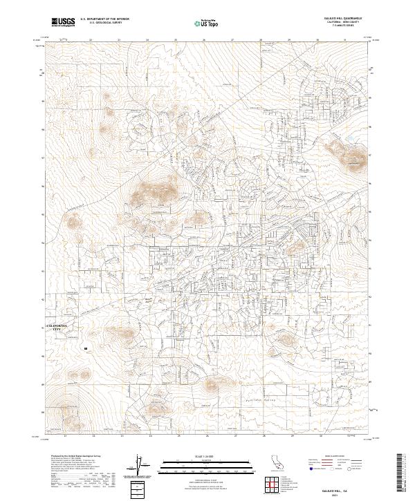
2021 Galileo Hill
Kern County, CA
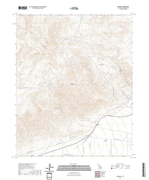
2021 Garlock
Kern County, CA
2021 Gosford
Kern County, CA
2021 Horse Canyon
Kern County, CA
2021 Inyokern SE
Kern County, CA
2021 Knob Hill
Kern County, CA
2021 Lake Isabella South
Kern County, CA
2021 Las Yeguas Ranch
Kern County, CA
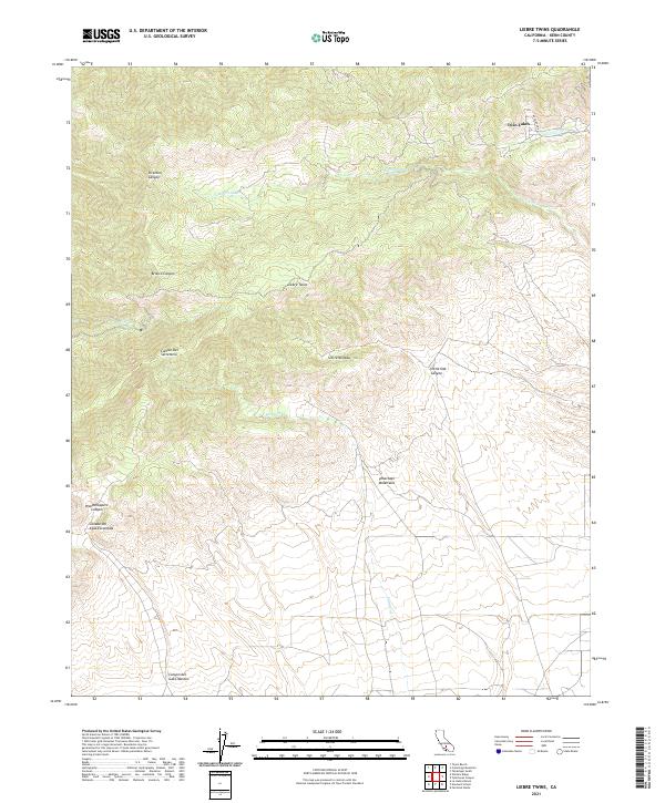
2021 Liebre Twins
Kern County, CA
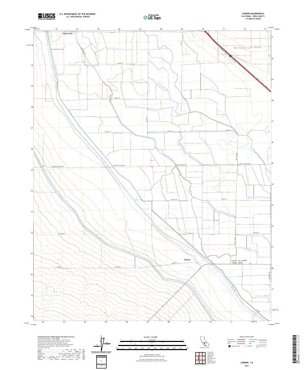
2021 Lokern
Kern County, CA
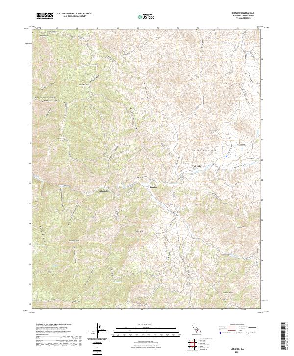
2021 Loraine
Kern County, CA
2021 Lost Hills NE
Kern County, CA
2021 Lost Hills NW
Kern County, CA
2021 McKittrick Summit
Kern County, CA
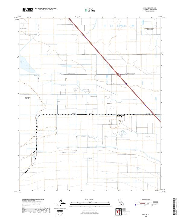
2021 Millux
Kern County, CA
2021 Mojave NE
Kern County, CA
2021 Mount Adelaide
Kern County, CA
2021 North of Oildale
Kern County, CA
2021 Oiler Peak
Kern County, CA
2021 Owens Peak
Kern County, CA
2021 Packwood Creek
Kern County, CA
2021 Pastoria Creek
Kern County, CA
2021 Pentland
Kern County, CA
2021 Pine Mountain
Kern County, CA
2021 Piute Peak
Kern County, CA
2021 Pleito Hills
Kern County, CA
2021 Pond
Kern County, CA
2021 Reward
Kern County, CA
2021 Ridgecrest North
Kern County, CA
2021 Ridgecrest South
Kern County, CA
2021 Rio Bravo
Kern County, CA
2021 Rio Bravo Ranch
Kern County, CA
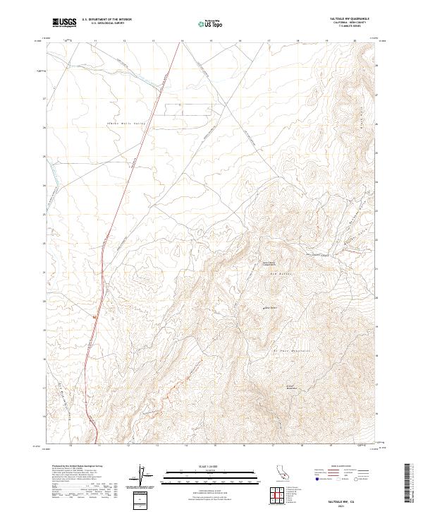
2021 Saltdale NW
Kern County, CA
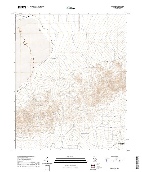
2021 Saltdale SE
Kern County, CA
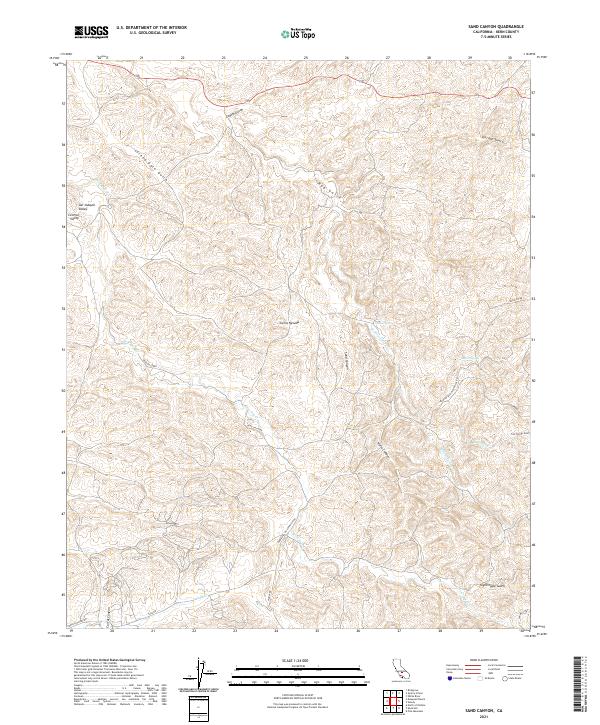
2021 Sand Canyon
Kern County, CA
2021 Santiago Creek
Kern County, CA
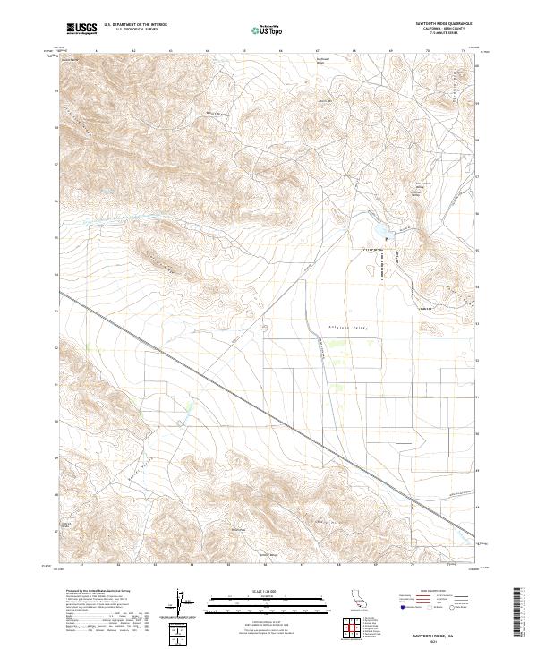
2021 Sawtooth Ridge
Kern County, CA
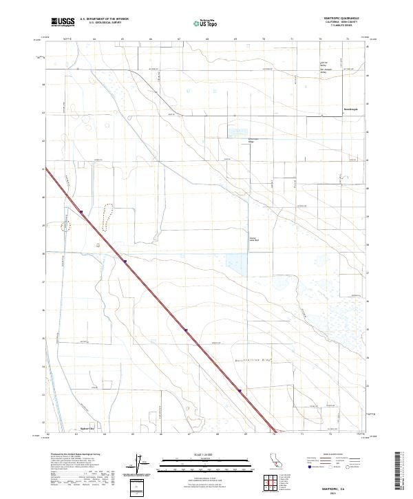
2021 Semitropic
Kern County, CA
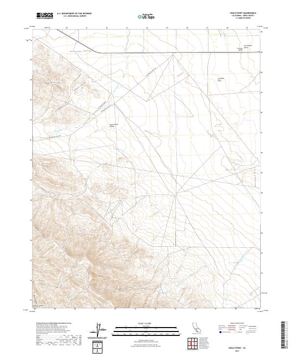
2021 Shale Point
Kern County, CA
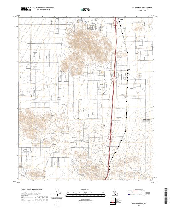
2021 Soledad Mountain
Kern County, CA
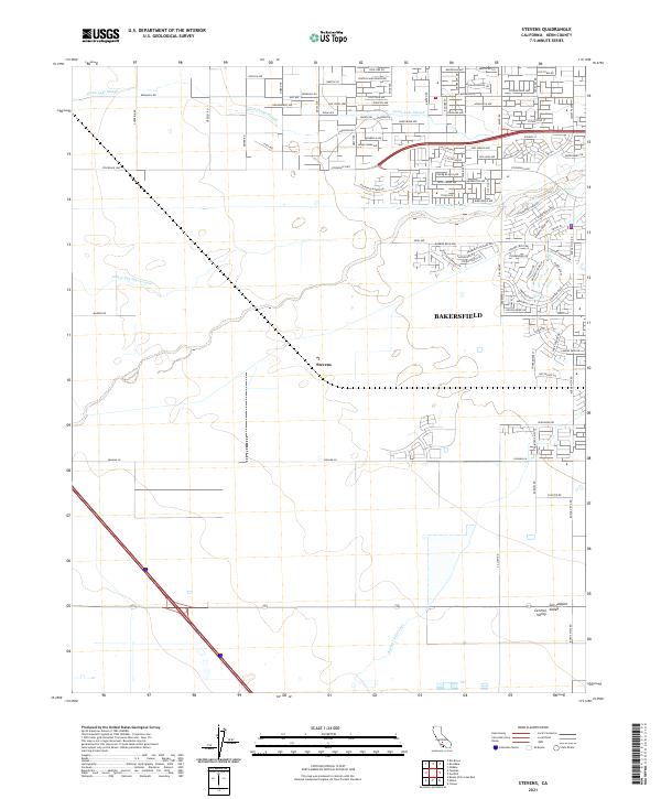
2021 Stevens
Kern County, CA
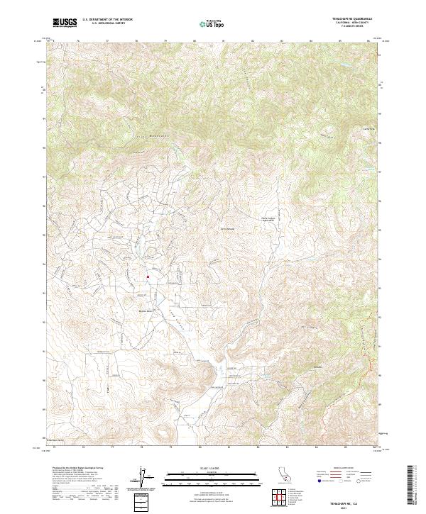
2021 Tehachapi NE
Kern County, CA
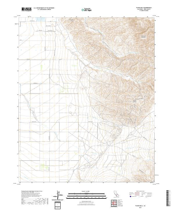
2021 Tejon Hills
Kern County, CA
2021 Tejon Ranch
Kern County, CA
2021 Tylerhorse Canyon
Kern County, CA
2021 Walker Pass
Kern County, CA
2021 Wasco NW
Kern County, CA
2021 Wasco SW
Kern County, CA
2021 Weed Patch
Kern County, CA
2021 West Elk Hills
Kern County, CA
2021 Willow Springs
Kern County, CA
2021 Woolstalf Creek
Kern County, CA
2022 Ballinger Canyon
Kern County, CA
2022 Bena
Kern County, CA
2022 Bissell
Kern County, CA
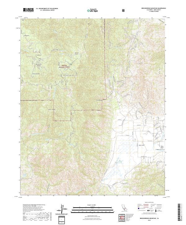
2022 Breckenridge Mountain
Kern County, CA
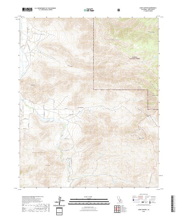
2022 Cane Canyon
Kern County, CA
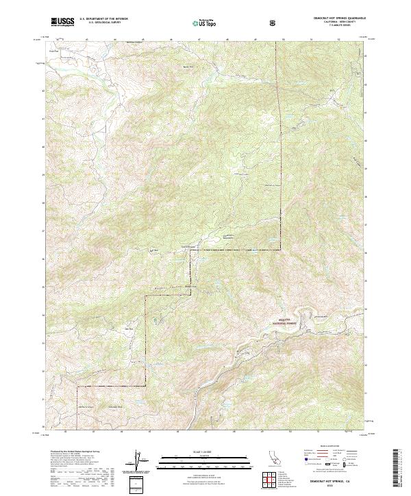
2022 Democrat Hot Springs
Kern County, CA
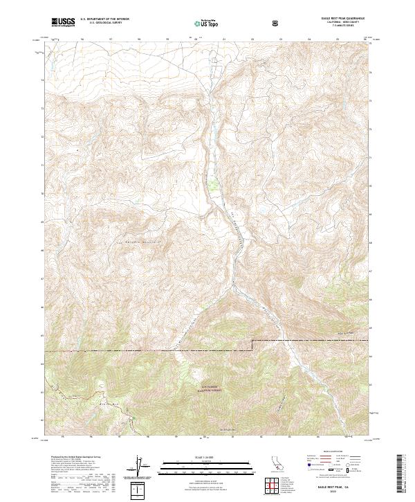
2022 Eagle Rest Peak
Kern County, CA
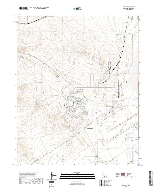
2022 Edwards
Kern County, CA
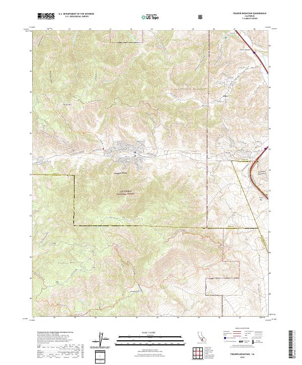
2022 Frazier Mountain
Kern County, CA
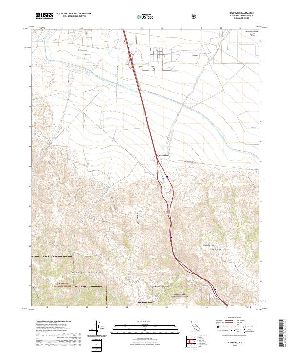
2022 Grapevine
Kern County, CA
2022 Lake Isabella North
Kern County, CA
2022 Leuhman Ridge
Kern County, CA
2022 Miracle Hot Springs
Kern County, CA
2022 Monolith
Kern County, CA
2022 Oil Center
Kern County, CA
2022 Pinyon Mountain
Kern County, CA
2022 Rogers Lake North
Kern County, CA
2022 Sanborn
Kern County, CA
2022 Tehachapi North
Kern County, CA
2022 Tehachapi South
Kern County, CA
2022 Winters Ridge
Kern County, CA