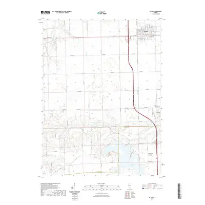
2021 Map of El Paso
USGS Topo · Published 2021About this map
El Paso stands as a central hub of Woodford County, defined by its rectilinear grid and proximity to the Mackinaw River. The landscape transitions from the urban density of El Paso down toward the village of Kappa and the expansive Evergreen Lake along the southern border. This area is characterized by a dense network of county roads, such as Co RD 1000 N and Co RD 2700 E, which provide access to a dispersed agricultural landscape and various family or community landmarks.
Find a feature on this map
78 named features on this map. Tap any name to fly to it.
Don’t see what you’re looking for? This feature index may not catch every label — zoom into the map to look around manually.
Map Details
Editions of this 2021 El Paso Map
This is the sole edition of this map. No revisions or reprints were ever made.
Other maps of this area

1926 · Normal
USGS Topo · 1:62,500

1927 · Danvers
USGS Topo · 1:62,500

1930 · Danvers
USGS Topo · 1:62,500

1930 · Normal
USGS Topo · 1:62,500

1955 · Minonk
USGS Topo · 1:62,500

1958 · Flanagan
USGS Topo · 1:62,500

1958 · Peoria
USGS Topo · 1:250,000

1961 · Peoria
USGS Topo · 1:250,000

1963 · Peoria
USGS Topo · 1:250,000
1970 · Secor
USGS Topo · 1:24,000