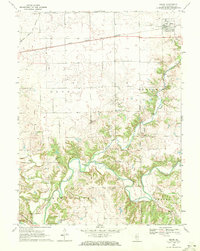
1970 Map of Secor
USGS Topo · Published 1972About this map
The Toledo Peoria and Western railroad corridors define the agricultural landscape north of the winding Mackinaw River in this 1970 snapshot of Woodford County. Centered on the town of Secor, the map reveals a community deeply tied to its geography, with several prominent religious landmarks including the Mennonite Cem and the Apostolic Christian Cem. Significant cultural history is marked at Nichols Mound (Indian Mound), which overlooks the river valley. The intricate drainage network of Panther Creek, Walnut Creek, and Vincent Run carves through the central townships of Olio and Palestine, showing the transition from flat prairie farmland to the more complex, wooded terrain surrounding the river and White Oak Lake. Downstream, the Robenstein Bridge provides a vital crossing point for local commerce and travel.
Find a feature on this map
23 named features on this map. Tap any name to fly to it.
Don’t see what you’re looking for? This feature index may not catch every label — zoom into the map to look around manually.
Map Details
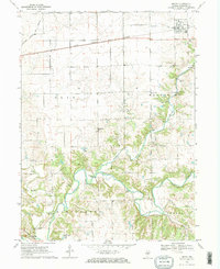
Editions of this 1970 Secor Map
2 editions found
Other maps of this area

1893 · Metamora
USGS Topo · 1:62,500

1927 · Danvers
USGS Topo · 1:62,500

1928 · Mackinaw
USGS Topo · 1:62,500

1930 · Danvers
USGS Topo · 1:62,500

1932 · Mackinaw
USGS Topo · 1:62,500

1937 · Metamora
USGS Topo · 1:62,500

1948 · Metamora
USGS Topo · 1:62,500

1955 · Minonk
USGS Topo · 1:62,500

1958 · Peoria
USGS Topo · 1:250,000

1961 · Peoria
USGS Topo · 1:250,000