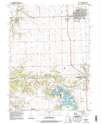
1995 Map of El Paso
USGS Topo · Published 1996About this map
El Paso serves as the primary municipal hub in the northern section of this Illinois landscape, situated at the junction of major transit corridors like Interchange 14. The terrain is defined by the winding course of the Mackinaw River, which carves through the southern half of the map, and the expansion of Evergreen Lake. This reservoir and the adjacent Comlara County Park represent a significant shift in land use toward recreation and water management for the surrounding townships.
Find a feature on this map
29 named features on this map. Tap any name to fly to it.
Don’t see what you’re looking for? This feature index may not catch every label — zoom into the map to look around manually.
Map Details
Editions of this 1995 El Paso Map
This is the sole edition of this map. No revisions or reprints were ever made.
Other maps of this area

1926 · Normal
USGS Topo · 1:62,500

1927 · Danvers
USGS Topo · 1:62,500

1930 · Danvers
USGS Topo · 1:62,500

1930 · Normal
USGS Topo · 1:62,500

1955 · Minonk
USGS Topo · 1:62,500

1958 · Flanagan
USGS Topo · 1:62,500

1958 · Peoria
USGS Topo · 1:250,000

1961 · Peoria
USGS Topo · 1:250,000

1963 · Peoria
USGS Topo · 1:250,000
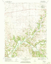
1970 · Secor
USGS Topo · 1:24,000