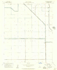
1954 Map of El Rico Ranch
USGS Topo · Published 1957About this map
The Tulare Lake Bed dominates this mid-century landscape in Kings County, revealing a highly engineered environment where water management dictated settlement patterns. Surveyed by the USGS during the administration of Governor Goodwin J. Knight, the map illustrates a transition from natural hydrology to intensive irrigation and reclamation. A complex network of levees and canals, including the Tule River and the Progressive Canal, crisscrosses the former lake bottom to support large-scale agricultural operations.
Find a feature on this map
36 named features on this map. Tap any name to fly to it.
Don’t see what you’re looking for? This feature index may not catch every label — zoom into the map to look around manually.
Map Details
Editions of this 1954 El Rico Ranch Map
3 editions found
Other maps of this area

1914 · Lost Hills
USGS Topo · 1:125,000

1928 · Waukena
USGS Topo · 1:31,680

1928 · Corcoran
USGS Topo · 1:31,680

1929 · Guernsey
USGS Topo · 1:31,680

1929 · Stratford
USGS Topo · 1:31,680

1929 · West Alpaugh
USGS Topo · 1:31,680

1931 · Harvester
USGS Topo · 1:31,680

1932 · El Rico Ranch
USGS Topo · 1:31,680

1932 · Dudley Ridge
USGS Topo · 1:31,680

1933 · Chatom Ranch
USGS Topo · 1:31,680