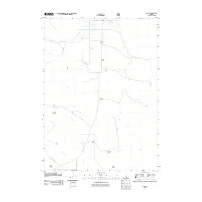
2011 Map of Elba
USGS Topo · Published 2011About this map
The settlement of Elba occupies the northern reach of this Cassia County landscape, situated where Cassia Creek and Clyde Creek converge. The terrain is defined by a series of named drainages and depressions that speak to the local ranching and geographical history, including Grassy Hollow, Poison Hollow, and the prominent Keg Hollow Canyon. To the west, the elevation rises sharply toward Thunder Mountain, overlooking the seasonal flows of Grape Creek and Waterfall Creek.
Find a feature on this map
38 named features on this map. Tap any name to fly to it.
Don’t see what you’re looking for? This feature index may not catch every label — zoom into the map to look around manually.
Map Details
Editions of this 2011 Elba Map
This is the sole edition of this map. No revisions or reprints were ever made.
Other maps of this area

1954 · Pocatello
USGS Topo · 1:250,000

1958 · Pocatello
USGS Topo · 1:250,000

1968 · Almo
USGS Topo · 1:24,000

1968 · Cache Peak
USGS Topo · 1:24,000

1968 · Jim Sage Canyon
USGS Topo · 1:24,000

1968 · Elba
USGS Topo · 1:24,000

1968 · Kane Canyon
USGS Topo · 1:24,000

1968 · Mount Harrison
USGS Topo · 1:24,000

1968 · Nibbs Creek
USGS Topo · 1:24,000

1968 · Chokecherry Canyon
USGS Topo · 1:24,000