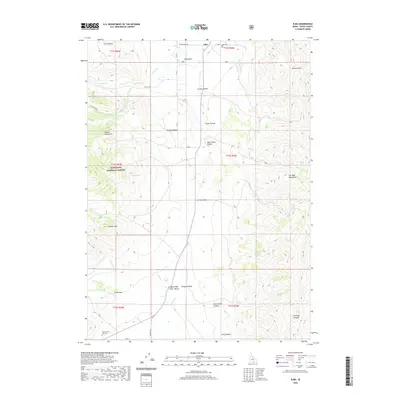
2020 Map of Elba
USGS Topo · Published 2020About this map
The settlement of Elba sits at the northern edge of this high-elevation basin, serving as a focal point for the surrounding cattle country. This 2020 map documents the transition from the rugged Albion Mountains in the west to the Upper Raft River Valley in the south, illustrating the drainage patterns of Cassia Cr and Summit Cr. Local history is anchored by sites such as Elba Cem and Sunny Cedar Rest Cem, while the vastness of the Sawtooth National Forest dominates the western topography. The map reveals a landscape defined by deeply cut drainages like Black Sand Hollow and prominent peaks including Thunder Mtn. For genealogists and researchers, the detailed mapping of springs such as Lloyd Spring and named hollows provides a clear record of family-named landmarks and water sources essential to the local ranching economy.
Find a feature on this map
47 named features on this map. Tap any name to fly to it.
Don’t see what you’re looking for? This feature index may not catch every label — zoom into the map to look around manually.
Map Details
Editions of this 2020 Elba Map
This is the sole edition of this map. No revisions or reprints were ever made.
Other maps of this area

1954 · Pocatello
USGS Topo · 1:250,000

1958 · Pocatello
USGS Topo · 1:250,000

1968 · Almo
USGS Topo · 1:24,000

1968 · Cache Peak
USGS Topo · 1:24,000

1968 · Jim Sage Canyon
USGS Topo · 1:24,000

1968 · Elba
USGS Topo · 1:24,000

1968 · Kane Canyon
USGS Topo · 1:24,000

1968 · Mount Harrison
USGS Topo · 1:24,000

1968 · Nibbs Creek
USGS Topo · 1:24,000

1968 · Chokecherry Canyon
USGS Topo · 1:24,000