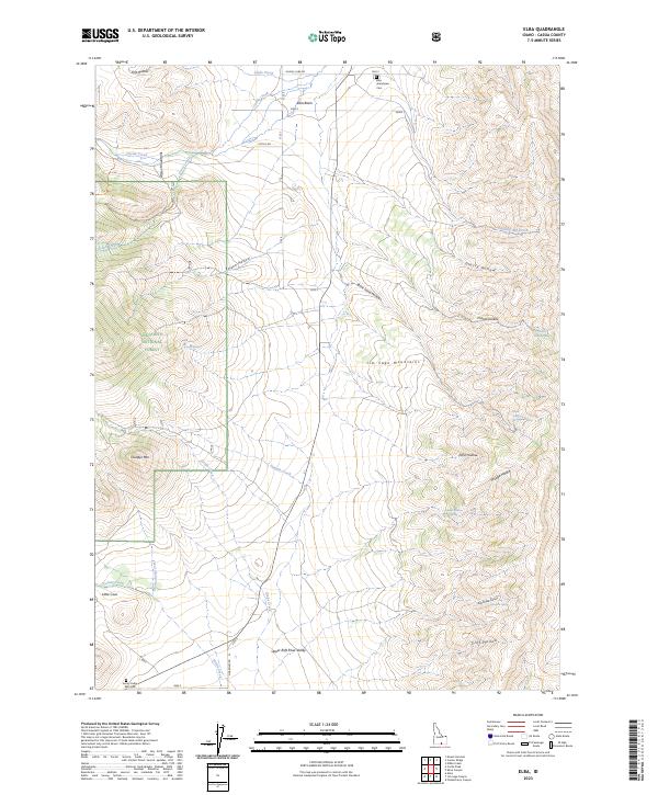
2023 Map of Elba
USGS Topo · Published 2023About this map
The Albion Mountains and Jim Sage Mountains dominate this high-altitude landscape in Cassia County, where the settlement of Elba Basin sits at the northern end of the Upper Raft River Valley. The terrain is defined by deep drainages and springs, including Cassia Creek, Clyde Creek, and the headwaters of Summit Creek. For genealogists and local historians, the map identifies significant burial sites like the Elba Grandview Cem and the Sunny Cedar Rest Cem, providing precise locations for family research in this rural pocket of Idaho. Much of the western portion of the sheet is managed as part of the Sawtooth National Forest, with the Cross Creek Trl cutting through the timbered slopes. Notable peaks and hollows, such as Thunder Mtn, Poison Hollow, and Echo Hollow, illustrate the complex topography that has historically shaped ranching and travel along the Oakley-Elba Rd.
Find a feature on this map
42 named features on this map. Tap any name to fly to it.
Don’t see what you’re looking for? This feature index may not catch every label — zoom into the map to look around manually.
Map Details
Editions of this 2023 Elba Map
This is the sole edition of this map. No revisions or reprints were ever made.
Other maps of this area

1954 · Pocatello
USGS Topo · 1:250,000

1958 · Pocatello
USGS Topo · 1:250,000

1968 · Almo
USGS Topo · 1:24,000

1968 · Cache Peak
USGS Topo · 1:24,000

1968 · Jim Sage Canyon
USGS Topo · 1:24,000

1968 · Elba
USGS Topo · 1:24,000

1968 · Kane Canyon
USGS Topo · 1:24,000

1968 · Mount Harrison
USGS Topo · 1:24,000

1968 · Nibbs Creek
USGS Topo · 1:24,000

1968 · Chokecherry Canyon
USGS Topo · 1:24,000