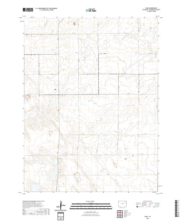
2022 Map of Elba
USGS Topo · Published 2022About this map
Elba sits within the high plains of Washington County, representing a sparse settlement pattern characteristic of eastern Colorado's agricultural landscape. The terrain is defined by the ephemeral drainage of Hell Cr, which winds through the central and northwestern sections of the quadrangle. This area is organized by a rigid grid of county roads, including Co Rd 29 and Co Rd 26, which follow the section lines of the Public Land Survey System.
Find a feature on this map
18 named features on this map. Tap any name to fly to it.
Don’t see what you’re looking for? This feature index may not catch every label — zoom into the map to look around manually.
Map Details
Editions of this 2022 Elba Map
This is the sole edition of this map. No revisions or reprints were ever made.
Other maps of this area

1954 · Limon
USGS Topo · 1:250,000

1954 · Sterling
USGS Topo · 1:250,000

1957 · Limon
USGS Topo · 1:250,000

1958 · Limon
USGS Topo · 1:250,000

1958 · Sterling
USGS Topo · 1:250,000

1973 · Antelope Creek East
USGS Topo · 1:24,000

1973 · Antelope Creek SE
USGS Topo · 1:24,000

1973 · Pinneo SE
USGS Topo · 1:24,000

1973 · Akron SE
USGS Topo · 1:24,000
1973 · Akron SW
USGS Topo · 1:24,000