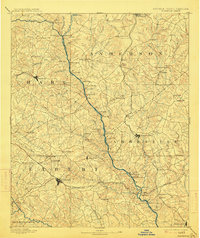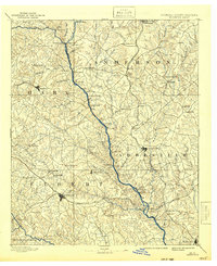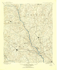
1893 Map of Elberton
USGS Topo · Published 1898About this map
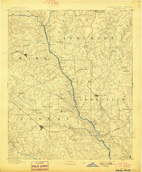
Elberton and the surrounding borderlands of Georgia and South Carolina are defined by the winding course of the Savannah River during the late nineteenth century. This era shows a landscape reliant on river crossings and localized industry, with numerous ferries such as Sloan Ferry, Browns Ferry, and Parks Ferry providing essential transit between Elbert, Hart, Abbeville, and Anderson counties. The agrarian economy is anchored by family-named hubs like Henley Store, Holland Store, and Irwin Store, while early industrial sites like Craft Mill and Adams Mill utilize the region's many creeks.
Find a feature on this map
101 named features on this map. Tap any name to fly to it.
Don’t see what you’re looking for? This feature index may not catch every label — zoom into the map to look around manually.
Map Details
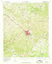
Editions of this 1893 Elberton Map
5 editions found