1957 Map of Elbing
USGS Topo · Published 1978About this map
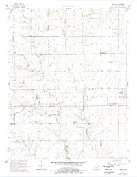
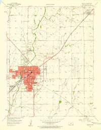
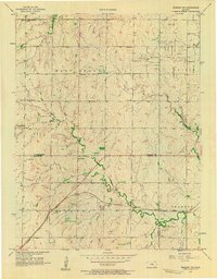
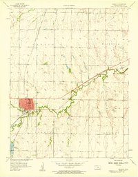
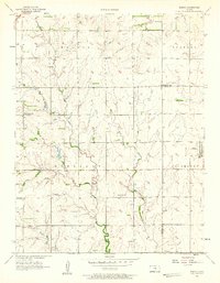
Elbing serves as the primary hub of this landscape, situated at the intersection of Butler, Marion, and Harvey counties during the mid-20th century. The settlement pattern is defined by rural institutions that anchored the surrounding farming communities, including the Grace Hill Ch and the Kelly Sch. This 1957 survey, with revisions from 1977, reveals a prairie environment intricately carved by several waterways, most notably the West Branch Walnut Creek and East Branch Whitewater Creek. These stream systems dictate the local topography, with the Mission Cem positioned near the convergence of several small tributaries. The map documents the persistent agricultural grid and the early development of infrastructure like pipelines crossing the northern sections, illustrating the transition from a purely agrarian economy to one integrating regional energy transport.
Find a feature on this map
14 named features on this map. Tap any name to fly to it.
Don’t see what you’re looking for? This feature index may not catch every label — zoom into the map to look around manually.
Map Details
Editions of this 1957 Elbing Map
2 editions found
Other maps of this area

1889 · Newton
USGS Topo · 1:125,000

1889 · Wichita
USGS Topo · 1:125,000

1894 · Wichita
USGS Topo · 1:125,000

1894 · Newton
USGS Topo · 1:125,000

1955 · Wichita
USGS Topo · 1:250,000

1955 · Hutchinson
USGS Topo · 1:250,000
1957 · Newton
USGS Topo · 1:24,000
1957 · Peabody NW
USGS Topo · 1:24,000
1957 · Peabody
USGS Topo · 1:24,000
1957 · Elbing
USGS Topo · 1:24,000