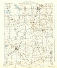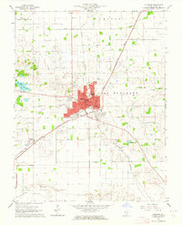
1963 Map of Eldorado
USGS Topo · Published 1964About this map
The city of Eldorado serves as a focal point for this 1963 survey, illustrating a landscape defined by its extractive industries and a dense network of transit. Multiple rail lines converge here, including the New York Central, Louisville and Nashville, and Illinois Central, which served the region's productive oil fields. The map identifies numerous Oil Wells across the Rector Field and East Eldorado Field, highlighting the economic importance of petroleum in Saline County during the mid-20th century.
Find a feature on this map
40 named features on this map. Tap any name to fly to it.
Don’t see what you’re looking for? This feature index may not catch every label — zoom into the map to look around manually.
Map Details
Editions of this 1963 Eldorado Map
This is the sole edition of this map. No revisions or reprints were ever made.
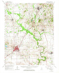
Historical Maps of Eldorado Through Time
9 maps found