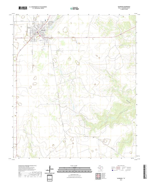
2022 Map of Eldorado
USGS Topo · Published 2022About this map
The Schleicher County Courthouse stands as the central landmark of Eldorado, anchoring a grid of residential and commercial streets that reflect the town's role as the county seat. This 2022 survey captures the community’s layout, from the residential blocks along E Hill Ave to the Eldorado Airport on the northwestern edge. The surrounding landscape is defined by the Edwards Plateau drainage patterns, where the headwaters of the S Concho River emerge. Intermittent waterways such as N Valley Prong and Antelope Draw carve through North Valley, illustrating the arid but geographically complex terrain of West Texas. Historically significant routes, including Old Mertzon Rd and Depot St, point to the town's evolution from a rail-dependent hub to a modern crossroads.
Find a feature on this map
41 named features on this map. Tap any name to fly to it.
Don’t see what you’re looking for? This feature index may not catch every label — zoom into the map to look around manually.
Map Details
Editions of this 2022 Eldorado Map
This is the sole edition of this map. No revisions or reprints were ever made.
Other maps of this area

1893 · Fort McKavett
USGS Topo · 1:125,000

1954 · Sonora
USGS Topo · 1:250,000

1958 · Sonora
USGS Topo · 1:250,000

1963 · Buffalo Well NW
USGS Topo · 1:24,000

1963 · Adams NW
USGS Topo · 1:24,000

1963 · Adams SW
USGS Topo · 1:24,000

1964 · Eldorado NW
USGS Topo · 1:24,000

1964 · Sonora NE
USGS Topo · 1:24,000

1964 · Eldorado SW
USGS Topo · 1:24,000

1964 · Sonora NW
USGS Topo · 1:24,000