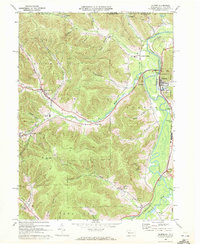
1969 Map of Eldred
USGS Topo · Published 1972About this map
The Bradford Oil Field dominates the western hills of this McKean County landscape, where numerous oil wells are scattered across the deep hollows of Kansas Branch and Knapp Creek. This era of the late 1960s captures the industrial character of northern Pennsylvania, defined by the winding course of the Allegheny River and the steady operations of the Penn Central railroad. Small settlements like Duke Center and Prentisvale are tucked into the valleys, while larger hubs like Eldred serve as local centers for schools such as Otto-Eldred High Sch.
Find a feature on this map
51 named features on this map. Tap any name to fly to it.
Don’t see what you’re looking for? This feature index may not catch every label — zoom into the map to look around manually.
Map Details
Editions of this 1969 Eldred Map
3 editions found
Other maps of this area

1898 · Olean
USGS Topo · 1:62,500

1900 · Salamanca
USGS Topo · 1:62,500

1924 · Bradford
USGS Topo · 1:62,500

1926 · Bradford
USGS Topo · 1:62,500

1933 · Smethport
USGS Topo · 1:62,500

1937 · Smethport
USGS Topo · 1:62,500

1938 · Salamanca
USGS Topo · 1:62,500

1938 · Olean
USGS Topo · 1:62,500

1941 · Bradford
USGS Topo · 1:62,500

1943 · Olean
USGS Topo · 1:62,500