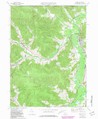
1969 Map of Eldred
USGS Topo · Published 1981About this map
The Allegheny River valley and its surrounding highlands define this portion of McKean County, where the industrial legacy of the Bradford Oil Field is written across the landscape. By the late 1960s, a dense network of oil wells and unimproved roads permeated the hills near Duke Center and Prentisvale, illustrating the area's continued reliance on petroleum extraction. Along the eastern edge of the quadrangle, the Conrail line parallels the river, connecting the primary settlement of Eldred with smaller communities like Larabee and Coryville.
Find a feature on this map
54 named features on this map. Tap any name to fly to it.
Don’t see what you’re looking for? This feature index may not catch every label — zoom into the map to look around manually.
Map Details
Editions of this 1969 Eldred Map
3 editions found
Other maps of this area

1898 · Olean
USGS Topo · 1:62,500

1900 · Salamanca
USGS Topo · 1:62,500

1924 · Bradford
USGS Topo · 1:62,500

1926 · Bradford
USGS Topo · 1:62,500

1933 · Smethport
USGS Topo · 1:62,500

1937 · Smethport
USGS Topo · 1:62,500

1938 · Salamanca
USGS Topo · 1:62,500

1938 · Olean
USGS Topo · 1:62,500

1941 · Bradford
USGS Topo · 1:62,500

1943 · Olean
USGS Topo · 1:62,500