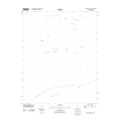
2011 Map of Elephant Butte
USGS Topo · Published 2011About this map
Elephant Butte and the Moccasin Mountains anchor this high-desert landscape in northern Arizona, where the terrain is defined by dramatic vertical relief and traditional livestock grazing grounds. The map detail highlights an intricate network of named geographic features including the White Cliffs, Harris Mountain, and the broad expanse of the Block Mesas. Historically significant water sources like Langston Willow Spring and Kane Spring are clearly marked, illustrating how life in this arid region was dictated by the proximity to reliable seeps. Transportation is concentrated in the southern portion of the quadrangle along County Hwy-43, which cuts through Rosy Canyon, while the rest of the area remains dominated by natural landmarks such as Sandstone Butte and Elephant Gap.
Find a feature on this map
17 named features on this map. Tap any name to fly to it.
Don’t see what you’re looking for? This feature index may not catch every label — zoom into the map to look around manually.
Map Details
Editions of this 2011 Elephant Butte Map
This is the sole edition of this map. No revisions or reprints were ever made.
Other maps of this area

1886 · Kanab
USGS Topo · 1:250,000

1886 · Kaibab
USGS Topo · 1:250,000

1953 · Cedar City
USGS Topo · 1:250,000

1953 · Grand Canyon
USGS Topo · 1:250,000

1954 · Kanab SW
USGS Topo · 1:24,000

1954 · Fredonia NW
USGS Topo · 1:24,000
1954 · Short Creek NW
USGS Topo · 1:24,000

1954 · Fredonia
USGS Topo · 1:62,500

1954 · Short Creek
USGS Topo · 1:62,500
1956 · Springdale SE
USGS Topo · 1:24,000