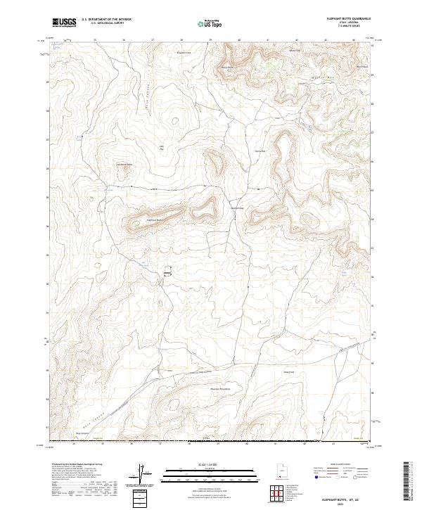
2023 Map of Elephant Butte
USGS Topo · Published 2023About this map
The Moccasin Mountains rise in the southern reaches of this Kane County terrain, where the high desert plateau meets the distinct white and red rock formations of the White Cliffs. The landscape is defined by its series of springs and seasonal water sources, such as Langston Willow Spring and Esplin Spring, which have historically provided critical hydration in this arid environment. Significant geologic landmarks like Elephant Butte and Sandstone Butte dominate the central topography, while Rock Canyon and Rosy Canyon carve deep passages through the surrounding mesas. In the southwest corner, the boundary of the Cottonwood Point Wilderness underscores the protected status of these remote canyons. Moving south, the high country transitions toward the sweeping dunes accessible via Coral Pink Sands Dunes Rd, reflecting the complex transition of sediment and stone in this section of southern Utah.
Find a feature on this map
35 named features on this map. Tap any name to fly to it.
Don’t see what you’re looking for? This feature index may not catch every label — zoom into the map to look around manually.
Map Details
Editions of this 2023 Elephant Butte Map
This is the sole edition of this map. No revisions or reprints were ever made.
Other maps of this area

1886 · Kanab
USGS Topo · 1:250,000

1886 · Kaibab
USGS Topo · 1:250,000

1953 · Cedar City
USGS Topo · 1:250,000

1953 · Grand Canyon
USGS Topo · 1:250,000

1954 · Kanab SW
USGS Topo · 1:24,000

1954 · Fredonia NW
USGS Topo · 1:24,000
1954 · Short Creek NW
USGS Topo · 1:24,000

1954 · Fredonia
USGS Topo · 1:62,500

1954 · Short Creek
USGS Topo · 1:62,500
1956 · Springdale SE
USGS Topo · 1:24,000