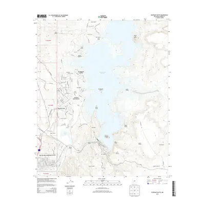
2013 Map of Elephant Butte
USGS Topo · Published 2013About this map
The waters of the Elephant Butte Reservoir and the winding course of the Rio Grande define this stretch of the New Mexico landscape. Along the western shoreline, the community of Elephant Butte Estates and the town of Truth or Consequences represent the primary centers of settlement, connected by a network of recreation-oriented roads like Lakeside Dr and Beach Blvd. The map reveals the intricate shoreline of the reservoir, highlighting landmarks such as Rattlesnake Island, Horse Island, and Long Point.
Find a feature on this map
109 named features on this map. Tap any name to fly to it.
Don’t see what you’re looking for? This feature index may not catch every label — zoom into the map to look around manually.
Map Details
Editions of this 2013 Elephant Butte Map
This is the sole edition of this map. No revisions or reprints were ever made.
Other maps of this area

1954 · Tularosa
USGS Topo · 1:250,000

1958 · Tularosa
USGS Topo · 1:250,000

1958 · Elephant Butte
USGS Topo · 1:24,000

1959 · Engle
USGS Topo · 1:62,500

1961 · Huerfano Hill
USGS Topo · 1:24,000

1961 · Black Bluffs
USGS Topo · 1:24,000

1961 · Crocker
USGS Topo · 1:24,000

1961 · Williamsburg
USGS Topo · 1:24,000

1961 · Cuchillo
USGS Topo · 1:24,000

1979 · Truth or Consequences
USGS Topo · 1:100,000
Featured Places
- Truth or Consequences, NM
- Elephant Butte, NM
- Rock Canyon, NM
- Hot Springs Landing, NM
- Elephant Butte Estates, NM