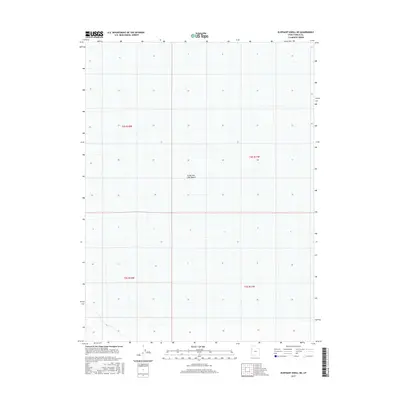
2017 Map of Elephant Knoll NE
USGS Topo · Published 2017About this map
Great Salt Lake Desert dominates this 2017 survey of Tooele County, Utah, providing a detailed record of the vast, arid interior of the eastern Great Basin. The map focuses on the desolate landscape within the Public Land Survey System grids of t4s r18w, t4s r17w, t5s r18w, and t5s r17w. This specific quadrangle captures the starkness of the salt flats before any modern encroachment, illustrating the section lines and township boundaries that define land ownership in this remote region. While largely devoid of settlements or industrial infrastructure, the map serves as an essential spatial baseline for understanding the topography and hydrography of one of the most distinctive geological environments in the American West.
Find a feature on this map
5 named features on this map. Tap any name to fly to it.
Don’t see what you’re looking for? This feature index may not catch every label — zoom into the map to look around manually.
Map Details
Editions of this 2017 Elephant Knoll NE Map
This is the sole edition of this map. No revisions or reprints were ever made.
Other maps of this area

1953 · Tooele
USGS Topo · 1:250,000

1955 · Tooele
USGS Topo · 1:250,000

1972 · Elephant Knoll
USGS Topo · 1:24,000
1972 · Elephant Knoll NW
USGS Topo · 1:24,000
1972 · Elephant Knoll NE
USGS Topo · 1:24,000

1972 · Elephant Knoll SE
USGS Topo · 1:24,000

1973 · Arinosa SW
USGS Topo · 1:24,000
1973 · Salduro SW
USGS Topo · 1:24,000

1973 · Salduro SE
USGS Topo · 1:24,000

1973 · Gold Hill 1 SW
USGS Topo · 1:24,000