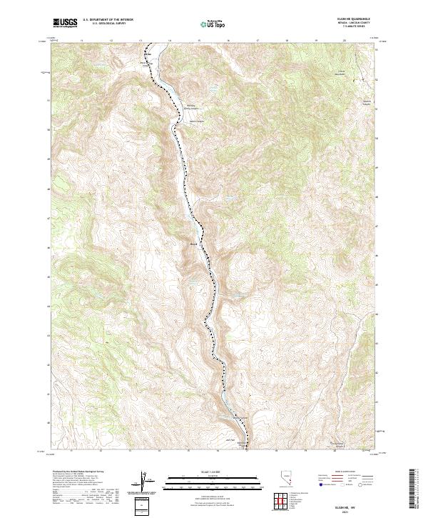
2021 Map of Elgin NE
USGS Topo · Published 2021About this map
Meadow Valley Wash defines the north-south corridor of this Lincoln County landscape, carving through high desert terrain between the Clover Mountains and the canyon-cut plateaus to the west. This valley has served as a vital transportation artery for decades, evidenced by the presence of the small settlements at Stine and Boyd located directly along the watercourse. The map reveals a complex network of canyons and drainage systems, such as Rock Springs Canyon and Whiskey Spring Canyon, which feed into the primary wash. Notable water sources like Flying Machine Spring and Hummingbird Spring are dotted throughout the higher elevations, while the southern portion of the quadrangle opens into the broader Ash Flat before narrowing again into the dramatic Rainbow Canyon.
Find a feature on this map
23 named features on this map. Tap any name to fly to it.
Don’t see what you’re looking for? This feature index may not catch every label — zoom into the map to look around manually.
Map Details
Editions of this 2021 Elgin NE Map
This is the sole edition of this map. No revisions or reprints were ever made.
Other maps of this area

1885 · Pioche
USGS Topo · 1:250,000

1886 · Pioche
USGS Topo · 1:250,000

1954 · Caliente
USGS Topo · 1:250,000

1959 · Caliente
USGS Topo · 1:250,000

1969 · Elgin
USGS Topo · 1:24,000

1969 · Elgin NE
USGS Topo · 1:24,000

1969 · Slidy Mountain
USGS Topo · 1:24,000

1969 · Elgin SW
USGS Topo · 1:24,000
1970 · Caliente
USGS Topo · 1:24,000
1970 · Chokecherry Mtn.
USGS Topo · 1:24,000