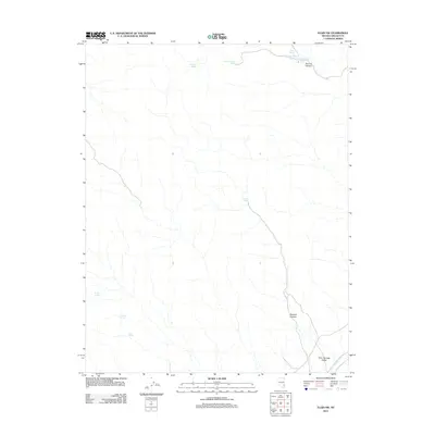
2012 Map of Elgin SW
USGS Topo · Published 2012About this map
Kane Springs Valley characterizes this high desert landscape in Lincoln County, where seasonal water sources and topographic relief define the territory. The map highlights a network of named springs that have historically served as critical landmarks for travel and land use in this arid region, including Sawmill Spring, Jump-Up Spring, and Pony Spring. These water points are often clustered around significant geological features such as Narrow Canyon and Boulder Canyon, illustrating the relationship between terrain and the availability of water. The presence of Kane Springs Wash running through the valley floor indicates the primary drainage pattern of this basin. This survey provides a baseline of the landscape's natural features and primitive road access as they existed in the early twenty-first century.
Find a feature on this map
13 named features on this map. Tap any name to fly to it.
Don’t see what you’re looking for? This feature index may not catch every label — zoom into the map to look around manually.
Map Details
Editions of this 2012 Elgin SW Map
This is the sole edition of this map. No revisions or reprints were ever made.
Other maps of this area

1885 · Pioche
USGS Topo · 1:250,000

1886 · Pioche
USGS Topo · 1:250,000

1954 · Caliente
USGS Topo · 1:250,000

1959 · Caliente
USGS Topo · 1:250,000

1969 · Vigo NW
USGS Topo · 1:24,000

1969 · Delamar
USGS Topo · 1:24,000

1969 · Gregerson Basin
USGS Topo · 1:24,000

1969 · Delamar 3 NE
USGS Topo · 1:24,000

1969 · Elgin
USGS Topo · 1:24,000

1969 · Elgin NE
USGS Topo · 1:24,000