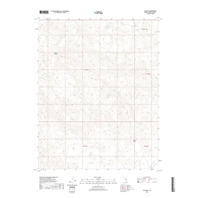
2018 Map of Elgin SW
USGS Topo · Published 2018About this map
The Delamar Mountains dominate this high-desert landscape in Lincoln County, Nevada, where water remains the most significant feature for survival and travel. The map identifies several critical water sources, including Sawmill Spring, Narrow Canyon Spring, and both Upper Riggs Spring and Lower Riggs Spring. These named springs, tucked into the complex topography, highlight the sparse but vital hydraulic network of the Great Basin. The terrain is deeply carved by drainage systems like Boulder Canyon and Narrow Canyon, which guide the seasonal flow of water through the arid peaks toward Home Springs Wash in the southeast. This 2018 survey serves as a detailed record of these named landmarks, which have historically supported ranching, mining, and through-travel in one of the most isolated regions of the American West.
Find a feature on this map
13 named features on this map. Tap any name to fly to it.
Don’t see what you’re looking for? This feature index may not catch every label — zoom into the map to look around manually.
Map Details
Editions of this 2018 Elgin SW Map
This is the sole edition of this map. No revisions or reprints were ever made.
Other maps of this area

1885 · Pioche
USGS Topo · 1:250,000

1886 · Pioche
USGS Topo · 1:250,000

1954 · Caliente
USGS Topo · 1:250,000

1959 · Caliente
USGS Topo · 1:250,000

1969 · Vigo NW
USGS Topo · 1:24,000

1969 · Delamar
USGS Topo · 1:24,000

1969 · Gregerson Basin
USGS Topo · 1:24,000

1969 · Delamar 3 NE
USGS Topo · 1:24,000

1969 · Elgin
USGS Topo · 1:24,000

1969 · Elgin NE
USGS Topo · 1:24,000