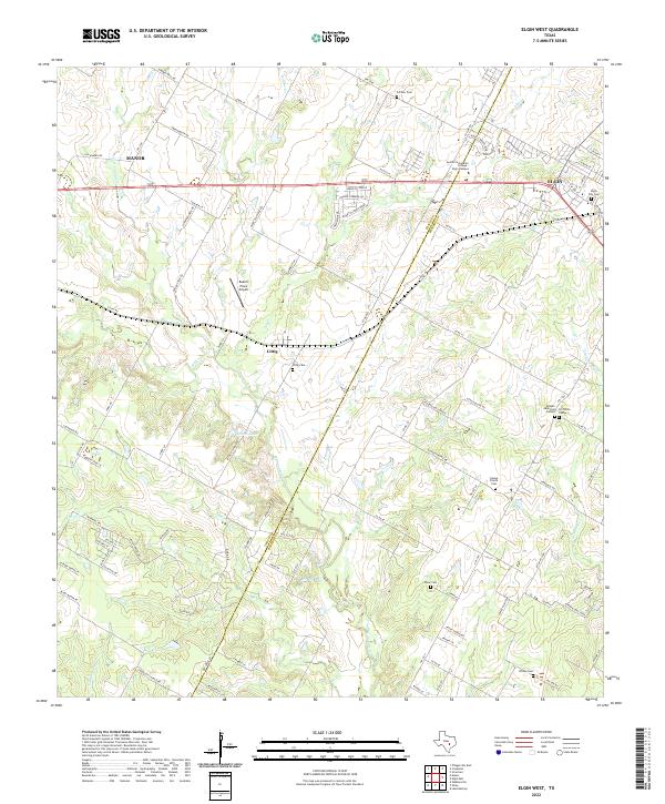
2022 Map of Elgin West
USGS Topo · Published 2022About this map
The Travis Co Bastrop Co boundary line cuts diagonally across this landscape where the expanding outskirts of Manor and Elgin meet. The area is defined by a dense network of tributaries including Cottonwood Cr, Wilbarger Cr, and Little Sandy Cr, which have historically shaped the agricultural and settlement patterns of this Central Texas region. Near the center of the map, the small community of Littig remains a point of interest for local historians, as it was established as a freedmen's town along the railroad during the late 19th century.
Find a feature on this map
101 named features on this map. Tap any name to fly to it.
Don’t see what you’re looking for? This feature index may not catch every label — zoom into the map to look around manually.
Map Details
Editions of this 2022 Elgin West Map
This is the sole edition of this map. No revisions or reprints were ever made.
Other maps of this area

1885 · Bastrop
USGS Topo · 1:125,000

1893 · Bastrop
USGS Topo · 1:125,000

1896 · Austin
USGS Topo · 1:125,000

1897 · Austin
USGS Topo · 1:125,000

1904 · Bastrop
USGS Topo · 1:125,000

1910 · Austin
USGS Topo · 1:125,000

1948 · Elgin
USGS Topo · 1:62,500

1948 · Bastrop
USGS Topo · 1:62,500

1950 · Bastrop
USGS Topo · 1:62,500

1950 · Elgin
USGS Topo · 1:62,500