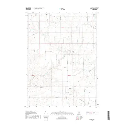
2018 Map of Elizabeth NE
USGS Topo · Published 2018About this map
Apple River and its numerous tributaries, including Kentucky Cr and the W Fork Apple River, define the dissected topography of this Jo Daviess County landscape. The settlement of Millville serves as a central point, situated near the confluence of Clear Creek and the main river channel. The area's history is preserved in its rural burial grounds, such as Saint Joseph Cem in the northwest and Elmwood Cem to the northeast, alongside the Thompson Cem near the southern boundary. Rising above the river valleys, Benton Mound provides a significant topographic landmark in the southern half of the quadrangle. The map details a complex network of local roads like N Canyon Park Rd and E Twin Bridges Rd that follow the winding drainage patterns of Lilly Br and Rush Cr, reflecting the region's enduring agricultural and residential layout.
Find a feature on this map
61 named features on this map. Tap any name to fly to it.
Don’t see what you’re looking for? This feature index may not catch every label — zoom into the map to look around manually.
Map Details
Editions of this 2018 Elizabeth NE Map
This is the sole edition of this map. No revisions or reprints were ever made.
Other maps of this area

1902 · Mineral Point
USGS Topo · 1:125,000

1911 · Elizabeth
USGS Topo · 1:62,500

1923 · South Wayne
USGS Topo · 1:62,500

1936 · Elizabeth
USGS Topo · 1:62,500

1937 · Lena
USGS Topo · 1:48,000

1942 · Lena
USGS Topo · 1:62,500

1943 · Lena
USGS Topo · 1:62,500

1952 · Shullsburg
USGS Topo · 1:24,000

1954 · Rockford
USGS Topo · 1:250,000

1955 · Rockford
USGS Topo · 1:250,000