Loading...
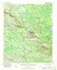
Loading map...1955 Map of Elizabethtown
USGS Topo · Published 1972About this map
The Cape Fear River carves a deep, winding path through the center of this mid-century survey, dividing the landscape into a complex network of swamps and Carolina bays. The county seat of Elizabethtown serves as the regional hub, supported by river infrastructure like Lock No 2 and the Virginia and Carolina Southern rail line. To the south, the Seaboard Air Line railroad anchors smaller settlements like Abbottsburg and Ruskin.
Find a feature on this map
148 named features on this map. Tap any name to fly to it.
Don’t see what you’re looking for? This feature index may not catch every label — zoom into the map to look around manually.
Map Details
Date Portrayed1955
Date Published1972
PublisherU.S. Geological Survey
Map TypeTopographic
Scale1:62,500
Physical Dimensions17 x 21 inches
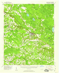
Editions of this 1955 Elizabethtown Map
2 editions found
Historical Maps of Elizabethtown Through Time

Featured Locations
Source Details
SourceU.S. Geological Survey
CopyrightPublic Domain