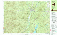
1978 Map of Elizabethtown
USGS Topo · Published 1979About this map
Elizabethtown and the hamlet of New Russia anchor this 1978 survey of the high peaks region. The landscape is defined by the steep elevation of Adirondack Park, featuring prominent summits such as Hurricane Mtn and Giant Mtn. The Boquet River winds through Pleasant Valley, fed by numerous tributaries including The Branch and Roaring Brook.
Find a feature on this map
66 named features on this map. Tap any name to fly to it.
Don’t see what you’re looking for? This feature index may not catch every label — zoom into the map to look around manually.
Map Details
Editions of this 1978 Elizabethtown Map
2 editions found
Other maps of this area

1894 · Elizabethtown
USGS Topo · 1:62,500

1894 · Port Henry
USGS Topo · 1:62,500

1895 · Willsboro
USGS Topo · 1:62,500

1895 · Elizabethtown
USGS Topo · 1:62,500

1895 · Mt. Marcy
USGS Topo · 1:62,500

1895 · Ausable
USGS Topo · 1:62,500

1896 · Lake Placid
USGS Topo · 1:62,500

1898 · Port Henry
USGS Topo · 1:62,500

1898 · Lake Placid
USGS Topo · 1:62,500

1901 · Elizabethtown
USGS Topo · 1:62,500