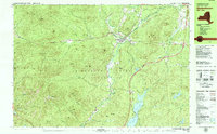
1978 Map of Elizabethtown
USGS Topo · Published 1979About this map
Elizabethtown and the nearby hamlet of New Russia are documented here in the late 1970s, situated in the high peaks region of the Adirondack Park. The landscape is dominated by the valley of the Bouquet River and its tributary, The Branch, which intersect near the village center. This area, serving as a county seat, displays established civic infrastructure including the Court House, a Hospital, and the Central School.
Find a feature on this map
91 named features on this map. Tap any name to fly to it.
Don’t see what you’re looking for? This feature index may not catch every label — zoom into the map to look around manually.
Map Details
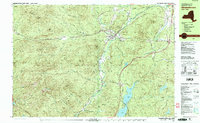
Editions of this 1978 Elizabethtown Map
2 editions found
Other maps of this area

1894 · Elizabethtown
USGS Topo · 1:62,500

1894 · Port Henry
USGS Topo · 1:62,500

1895 · Willsboro
USGS Topo · 1:62,500

1895 · Elizabethtown
USGS Topo · 1:62,500

1895 · Mt. Marcy
USGS Topo · 1:62,500

1895 · Ausable
USGS Topo · 1:62,500

1896 · Lake Placid
USGS Topo · 1:62,500

1898 · Port Henry
USGS Topo · 1:62,500

1898 · Lake Placid
USGS Topo · 1:62,500

1901 · Elizabethtown
USGS Topo · 1:62,500