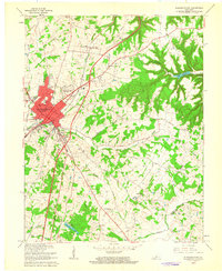
1960 Map of Elizabethtown
USGS Topo · Published 1962About this map
Elizabethtown serves as the focal point of this 1960 revision, showing the community just as the Kentucky Turnpike (Toll Road) began to reshape local transit. The map documents a blend of established civic life and new expansion, including the Elizabethtown Country Club and residential pockets like Indian Hills. Educational and religious institutions are dense within the town, from St James High Sch to the Morningside Sch. Outside the urban center, the landscape remains defined by agricultural drainage along Valley Creek and Middle Creek.
Find a feature on this map
60 named features on this map. Tap any name to fly to it.
Don’t see what you’re looking for? This feature index may not catch every label — zoom into the map to look around manually.
Map Details
Editions of this 1960 Elizabethtown Map
2 editions found
Other maps of this area

1935 · Elizabethtown
USGS Topo · 1:48,000

1936 · Vine Grove
USGS Topo · 1:62,500

1938 · Elizabethtown
USGS Topo · 1:62,500

1943 · Vine Grove
USGS Topo · 1:62,500

1946 · Colesburg
USGS Topo · 1:24,000

1946 · Vine Grove
USGS Topo · 1:24,000

1946 · Vine Grove
USGS Topo · 1:62,500

1948 · Cecilia
USGS Topo · 1:24,000

1949 · Sonora
USGS Topo · 1:24,000

1949 · Tonieville
USGS Topo · 1:24,000