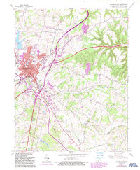
1967 Map of Elizabethtown
USGS Topo · Published 1987About this map
Elizabethtown serves as a significant crossroads in central Kentucky during the late 1960s, defined by the convergence of major infrastructure and historic community landmarks. The landscape is characterized by the expansion of transportation corridors, including the Kentucky Toll Road, Blue Grass Parkway, and Western Kentucky Parkway, which wrap around the city's southern and eastern fringes. This growth is juxtaposed with established local institutions like St James Sch, Severns Valley Sch, and several family cemeteries such as Helm Cem and Browns Cem. To the north, Freeman Lake provides a notable water feature near the residential development of Indian Hills. The map also captures the path of the Paducah & Louisville and CSX railroads, reflecting the area's role as a transit hub between ridges like Tunnel Hill and the branching waters of Valley Creek.
Find a feature on this map
73 named features on this map. Tap any name to fly to it.
Don’t see what you’re looking for? This feature index may not catch every label — zoom into the map to look around manually.
Map Details
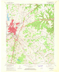
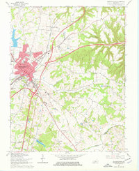
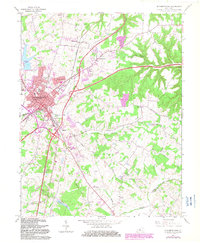
Editions of this 1967 Elizabethtown Map
4 editions found
Other maps of this area

1935 · Elizabethtown
USGS Topo · 1:48,000

1936 · Vine Grove
USGS Topo · 1:62,500

1938 · Elizabethtown
USGS Topo · 1:62,500

1943 · Vine Grove
USGS Topo · 1:62,500

1946 · Colesburg
USGS Topo · 1:24,000

1946 · Vine Grove
USGS Topo · 1:24,000

1946 · Vine Grove
USGS Topo · 1:62,500

1948 · Cecilia
USGS Topo · 1:24,000

1949 · Sonora
USGS Topo · 1:24,000

1949 · Tonieville
USGS Topo · 1:24,000