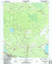
1987 Map of Elizabethtown North
USGS Topo · Published 1987About this map
The Cape Fear River anchors this coastal plain landscape, where river-based infrastructure like the U S Lock and Dam No 2 and Browns Landing supported local commerce. The terrain is characterized by the distinctive Carolina Bays, elliptical depressions such as Jones Lake and Salters Lake that form the core of Jones Lake State Park. These natural features are surrounded by the extensive Bladen Lakes State Forest, which integrates timber resources with recreational spaces like the local Golf Course.
Find a feature on this map
60 named features on this map. Tap any name to fly to it.
Don’t see what you’re looking for? This feature index may not catch every label — zoom into the map to look around manually.
Map Details
Editions of this 1987 Elizabethtown North Map
This is the sole edition of this map. No revisions or reprints were ever made.
Other maps of this area

1953 · Florence
USGS Topo · 1:250,000

1954 · Florence
USGS Topo · 1:250,000

1954 · White Lake
USGS Topo · 1:62,500

1955 · Elizabethtown
USGS Topo · 1:62,500

1959 · Roseboro
USGS Topo · 1:62,500

1959 · Garland
USGS Topo · 1:62,500

1982 · Elizabethtown
USGS Topo · 1:100,000
1986 · Garland
USGS Topo · 1:24,000
1986 · Singletary Lake
USGS Topo · 1:24,000
1986 · White Lake
USGS Topo · 1:24,000