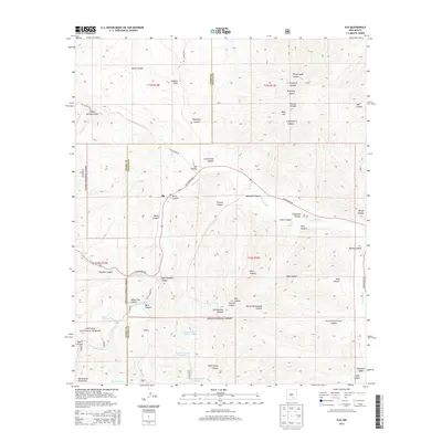
2013 Map of Elk
USGS Topo · Published 2013About this map
The high canyon country of the Sacramento Mountains defines this 2013 study, where the small settlement of Elk sits along the banks of the Rio Peñasco. This drainage is a critical corridor in the arid landscape, supporting the Elk Cem and various ranching infrastructure within the Lincoln National Forest. The topography is a complex network of named draws and canyons, including Graveyard Canyon and Telephone Canyon, which indicate the early 20th-century arrival of communication lines in these remote uplands.
Find a feature on this map
52 named features on this map. Tap any name to fly to it.
Don’t see what you’re looking for? This feature index may not catch every label — zoom into the map to look around manually.
Map Details
Editions of this 2013 Elk Map
This is the sole edition of this map. No revisions or reprints were ever made.
Other maps of this area

1954 · Carlsbad
USGS Topo · 1:250,000

1955 · Roswell
USGS Topo · 1:250,000

1958 · Carlsbad
USGS Topo · 1:250,000

1958 · Roswell
USGS Topo · 1:250,000

1961 · Flying H
USGS Topo · 1:62,500

1962 · Roswell
USGS Topo · 1:250,000

1962 · Dunken
USGS Topo · 1:62,500

1963 · Clements Ranch
USGS Topo · 1:24,000

1963 · Mayhill
USGS Topo · 1:24,000

1963 · Turkey Peak
USGS Topo · 1:24,000