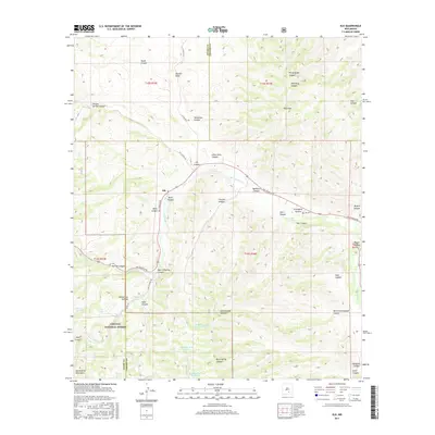
2017 Map of Elk
USGS Topo · Published 2017About this map
The high-country terrain of the Sacramento Mountains defines this 2017 survey, where the small community of Elk sits along the Rio Peñasco Rd. This landscape is marked by a complex network of canyons and draws, including Graveyard Canyon and Sixteen Springs Canyon, reflecting a topography that dictates the local infrastructure. The Rio Peñasco and its tributaries, such as Agua Chiquita Cr, serve as the primary drainage systems, with various water storage points like Mathews Tank Number Three and Gravel Tank scattered across the range. A significant portion of the land falls within the Lincoln National Forest, preserving the wooded character of the region. Genealogists may find particular interest in the Elk Cem, located near the intersection of the primary river road and Elk Canyon, which serves as a vital record for the families who settled this portion of the Otero and Chaves County borderlands.
Find a feature on this map
53 named features on this map. Tap any name to fly to it.
Don’t see what you’re looking for? This feature index may not catch every label — zoom into the map to look around manually.
Map Details
Editions of this 2017 Elk Map
This is the sole edition of this map. No revisions or reprints were ever made.
Other maps of this area

1954 · Carlsbad
USGS Topo · 1:250,000

1955 · Roswell
USGS Topo · 1:250,000

1958 · Carlsbad
USGS Topo · 1:250,000

1958 · Roswell
USGS Topo · 1:250,000

1961 · Flying H
USGS Topo · 1:62,500

1962 · Roswell
USGS Topo · 1:250,000

1962 · Dunken
USGS Topo · 1:62,500

1963 · Clements Ranch
USGS Topo · 1:24,000

1963 · Mayhill
USGS Topo · 1:24,000

1963 · Turkey Peak
USGS Topo · 1:24,000