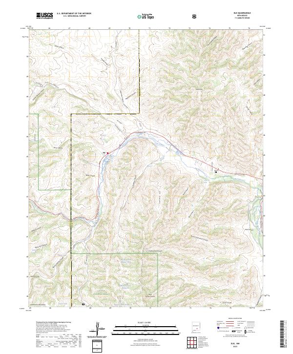
2023 Map of Elk
USGS Topo · Published 2023About this map
The settlement of Elk and its surrounding canyonlands are documented here, situated along the winding course of the Rio Peñasco. This high-altitude landscape is characterized by its complex drainage network, where names like Agua Chiquita Creek and Little Felix Canyon suggest the importance of seasonal water in this arid environment. The map captures the rugged interior of the Lincoln National Forest, reaching into the Sacramento Mountains and marked by landmarks such as Wind Mtn. Local history is preserved in the location of the Elk Cem and family-named features like Clements Ranch and Bates Canyon. A series of specialized water sources, including Mathews-Tank Number One and Turpin Tank, dot the terrain, illustrating the infrastructure required for ranching and forest management in this New Mexico interior.
Find a feature on this map
59 named features on this map. Tap any name to fly to it.
Don’t see what you’re looking for? This feature index may not catch every label — zoom into the map to look around manually.
Map Details
Editions of this 2023 Elk Map
This is the sole edition of this map. No revisions or reprints were ever made.
Other maps of this area

1954 · Carlsbad
USGS Topo · 1:250,000

1955 · Roswell
USGS Topo · 1:250,000

1958 · Carlsbad
USGS Topo · 1:250,000

1958 · Roswell
USGS Topo · 1:250,000

1961 · Flying H
USGS Topo · 1:62,500

1962 · Roswell
USGS Topo · 1:250,000

1962 · Dunken
USGS Topo · 1:62,500

1963 · Clements Ranch
USGS Topo · 1:24,000

1963 · Mayhill
USGS Topo · 1:24,000

1963 · Turkey Peak
USGS Topo · 1:24,000