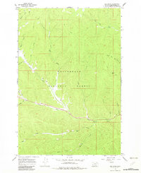
1966 Map of Elk Creek
USGS Topo · Published 1982About this map
Beaverhead National Forest land defines this portion of the Montana high country, where a network of watercourses and trails marks the landscape during the mid-1960s. The convergence of Elk Creek and Joseph Creek creates a primary drainage system through the central terrain, supported by numerous smaller tributaries like Cabinet Creek and Shoofly Cr. This area served as a vital recreational and transit corridor, evidenced by the May Creek Campground situated along the waters of May Creek. Navigation through the dense timber and varying elevations relied on established routes such as the Sunshine Trail and several unnamed Pack Trails and Jeep Trails. The map illustrates the headwaters of several drainages, including South Fork Tie Creek and Boulder Creek, which flow toward neighboring basins, reflecting the complex topography of Beaverhead County.
Find a feature on this map
23 named features on this map. Tap any name to fly to it.
Don’t see what you’re looking for? This feature index may not catch every label — zoom into the map to look around manually.
Map Details
Editions of this 1966 Elk Creek Map
2 editions found
Other maps of this area

1955 · Dillon
USGS Topo · 1:250,000

1957 · Dillon
USGS Topo · 1:250,000

1958 · Dillon
USGS Topo · 1:250,000

1962 · Dillon
USGS Topo · 1:250,000

1965 · Dillon
USGS Topo · 1:250,000

1966 · Lost Trail Pass
USGS Topo · 1:24,000

1966 · Big Hole Battlefield
USGS Topo · 1:24,000

1966 · Big Hole Pass
USGS Topo · 1:24,000
1966 · Elk Creek
USGS Topo · 1:24,000
1966 · Isaac Meadows
USGS Topo · 1:24,000