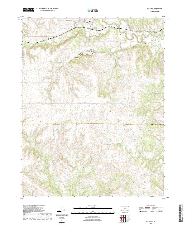
2022 Map of Elk Falls
USGS Topo · Published 2022About this map
Elk Falls sits at the northern edge of this landscape, where the Elk River winds through the limestone hills of southeastern Kansas. The settlement layout is defined by streets like Wyandotte St and Osage, positioned just south of the river's bend and the mouth of Wildcat Creek. The terrain is deeply incised by a dense network of drainages, including Clear Creek and N Salt Cr, which carve through the high prairie ground between the Elk and Caney river systems.
Find a feature on this map
35 named features on this map. Tap any name to fly to it.
Don’t see what you’re looking for? This feature index may not catch every label — zoom into the map to look around manually.
Map Details
Editions of this 2022 Elk Falls Map
This is the sole edition of this map. No revisions or reprints were ever made.
Other maps of this area

1885 · Sedan
USGS Topo · 1:125,000

1889 · Sedan
USGS Topo · 1:125,000

1955 · Wichita
USGS Topo · 1:250,000

1958 · Wichita
USGS Topo · 1:250,000
1962 · Oak Valley
USGS Topo · 1:24,000

1962 · Moline
USGS Topo · 1:24,000
1962 · Elk Falls
USGS Topo · 1:24,000

1962 · Sedan
USGS Topo · 1:24,000

1962 · Elgin NE
USGS Topo · 1:24,000
1962 · Hale
USGS Topo · 1:24,000