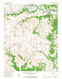
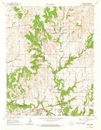
1962 Map of Elk Falls
USGS Topo · Published 1963About this map
The settlement of Elk Falls sits at a geographic crossroads where the Atchison Topeka and Santa Fe railroad tracks parallel the Elk River. This early 1960s survey documents a landscape defined by its riparian networks and the transition between Elk and Chautauqua counties. The northern portion of the map is dominated by the river's winding course and tributaries like Wildcat Creek, while the southern reaches move into more dissected terrain across the Lafayette and Longton districts.
Find a feature on this map
13 named features on this map. Tap any name to fly to it.
Don’t see what you’re looking for? This feature index may not catch every label — zoom into the map to look around manually.
Map Details
Editions of this 1962 Elk Falls Map
2 editions found
Other maps of this area

1885 · Sedan
USGS Topo · 1:125,000

1889 · Sedan
USGS Topo · 1:125,000

1955 · Wichita
USGS Topo · 1:250,000

1958 · Wichita
USGS Topo · 1:250,000
1962 · Oak Valley
USGS Topo · 1:24,000

1962 · Moline
USGS Topo · 1:24,000

1962 · Sedan
USGS Topo · 1:24,000

1962 · Elgin NE
USGS Topo · 1:24,000
1962 · Hale
USGS Topo · 1:24,000
1964 · Longton
USGS Topo · 1:24,000