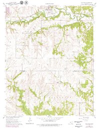
1962 Map of Elk Falls
USGS Topo · Published 1979About this map
Elk Falls serves as the primary hub of activity in this region, situated where the Atchison Topeka and Santa Fe railroad corridor runs parallel to the winding course of the Elk River. The map highlights a distinct transition from the river valley's transit and settlement infrastructure to the rolling uplands of Center and Lafayette townships. In the southern reaches of the quadrangle, particularly along North Caney Creek, numerous Oil Wells indicate the active energy extraction present during the mid-century. A network of drainages including Wildcat Creek, Clear Creek, and both the North Salt Creek and South Salt Creek define the dissection of the landscape, providing essential context for understanding early land use and the placement of field lines and rural dwellings across the Elk and Chautauqua County line.
Find a feature on this map
13 named features on this map. Tap any name to fly to it.
Don’t see what you’re looking for? This feature index may not catch every label — zoom into the map to look around manually.
Map Details
Editions of this 1962 Elk Falls Map
2 editions found
Other maps of this area

1885 · Sedan
USGS Topo · 1:125,000

1889 · Sedan
USGS Topo · 1:125,000

1955 · Wichita
USGS Topo · 1:250,000

1958 · Wichita
USGS Topo · 1:250,000
1962 · Oak Valley
USGS Topo · 1:24,000

1962 · Moline
USGS Topo · 1:24,000
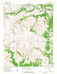
1962 · Elk Falls
USGS Topo · 1:24,000

1962 · Sedan
USGS Topo · 1:24,000

1962 · Elgin NE
USGS Topo · 1:24,000
1962 · Hale
USGS Topo · 1:24,000