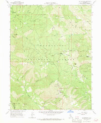
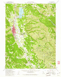
1967 Map of Elk Mountain
USGS Topo · Published 1969About this map
Enterprise and Howard Mill Station serve as quiet anchors in this mountainous landscape, as documented in this 1967 field check by the Geological Survey and the California Department of Water Resources. The terrain is defined by the winding course of Benmore Creek and the intricate drainage patterns of the Mendocino National Forest. The presence of a mill station suggests the local economic reliance on timber and resource management during the mid-twentieth century. This survey provides a precise record of the road network and water features prior to significant late-century shifts in forest land use, making it a reliable resource for tracing the geographical footprint of these specific interior California outposts.
Find a feature on this map
3 named features on this map. Tap any name to fly to it.
Don’t see what you’re looking for? This feature index may not catch every label — zoom into the map to look around manually.
Map Details
Editions of this 1967 Elk Mountain Map
4 editions found
Other maps of this area

1920 · Ukiah
USGS Topo · 1:62,500

1922 · Hullville
USGS Topo · 1:62,500

1938 · Lakeport
USGS Topo · 1:62,500

1943 · Pomo
USGS Topo · 1:62,500

1944 · Ukiah
USGS Topo · 1:62,500

1951 · Lake Pillsbury
USGS Topo · 1:62,500

1951 · Lakeport
USGS Topo · 1:62,500

1957 · Ukiah
USGS Topo · 1:250,000

1958 · Cow Mountain
USGS Topo · 1:24,000
1958 · Ukiah
USGS Topo · 1:62,500