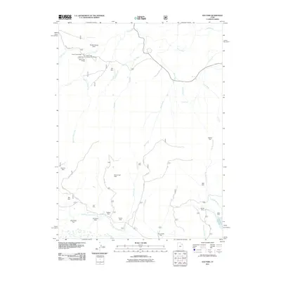
2011 Map of Elk Park
USGS Topo · Published 2011About this map
Oaks Park Reservoir and the high-elevation meadows of Uintah County define this 2011 survey of the Uinta Mountains. The landscape is characterized by a series of open grassy areas known as parks, including Soldier Park, Summit Park, and Lost Park, which are interspersed among the drainages of Carter Creek and Elk Creek. These parklands often served as seasonal grazing grounds and landmarks for early travelers and Forest Service rangers in the Ashley National Forest.
Find a feature on this map
43 named features on this map. Tap any name to fly to it.
Don’t see what you’re looking for? This feature index may not catch every label — zoom into the map to look around manually.
Map Details
Editions of this 2011 Elk Park Map
This is the sole edition of this map. No revisions or reprints were ever made.
Other maps of this area

1885 · Ashley
USGS Topo · 1:250,000

1906 · Marsh Peak
USGS Topo · 1:125,000

1908 · Marsh Peak
USGS Topo · 1:125,000

1950 · Dyer Mountain
USGS Topo · 1:24,000

1952 · Flaming Gorge
USGS Topo · 1:24,000

1954 · Vernal
USGS Topo · 1:250,000

1958 · Vernal
USGS Topo · 1:250,000

1960 · Vernal
USGS Topo · 1:250,000
1963 · Manila
USGS Topo · 1:24,000
1963 · Leidy Peak
USGS Topo · 1:24,000