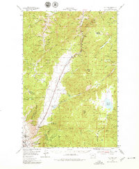
1954 Map of Elk Park
USGS Topo · Published 1978About this map
The Continental Divide runs prominently through this 1954 survey of Jefferson County, following the high ridges of Rampart Mountain and Sheepshead Mountain. This high-altitude landscape is defined by the headwaters of the Boulder River and Bison Creek, where a network of gulches and creeks—including Kit Carson Gulch and Buffalo Gulch—drains the eastern slopes. The settlement pattern reflects the area's mid-century transit and industrial needs, anchored by the Great Northern and Northern Pacific railroads that parallel the valleys.
Find a feature on this map
78 named features on this map. Tap any name to fly to it.
Don’t see what you’re looking for? This feature index may not catch every label — zoom into the map to look around manually.
Map Details
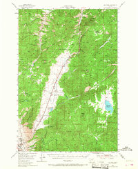
Editions of this 1954 Elk Park Map
3 editions found
Other maps of this area

1889 · Helena
USGS Topo · 1:250,000

1893 · Helena
USGS Topo · 1:250,000

1893 · Dillon
USGS Topo · 1:250,000

1899 · Boulder
USGS Topo · 1:125,000

1899 · Helena
USGS Topo · 1:250,000

1903 · Helena
USGS Topo · 1:250,000

1947 · Butte
USGS Topo · 1:250,000

1950 · Jefferson City
USGS Topo · 1:62,500

1954 · Elk Park
USGS Topo · 1:62,500

1954 · Basin
USGS Topo · 1:62,500