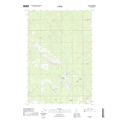
2020 Map of Elk River
USGS Topo · Published 2020About this map
Elk River serves as the primary settlement in this Clearwater County landscape, where the confluence of several mountain streams defines the local geography. The town is flanked by the W Fork Elk Cr and the main branch of Elk Cr, which flow through a network of ridges and high meadows. To the south, the Three Pines Cem and the Elk River Airport sit near the valley floor, marking the community's established infrastructure. The surrounding terrain is characterized by prominent elevations such as Shattuck Butte and Windy Point, while broad openings like Christianson Meadows and Robideaux Meadows break the forested slopes. A sophisticated network of forest development roads, including Elk Creek Falls Rd and Dent Rd, provides access across the drainage basins of Lindley Cr and Shattuck Cr.
Find a feature on this map
44 named features on this map. Tap any name to fly to it.
Don’t see what you’re looking for? This feature index may not catch every label — zoom into the map to look around manually.
Map Details
Editions of this 2020 Elk River Map
This is the sole edition of this map. No revisions or reprints were ever made.
Other maps of this area

1955 · Pullman
USGS Topo · 1:250,000

1958 · Pullman
USGS Topo · 1:250,000

1961 · Ahsahka
USGS Topo · 1:62,500

1961 · Bovill
USGS Topo · 1:62,500

1969 · Elk River
USGS Topo · 1:24,000

1969 · Elk Creek Falls
USGS Topo · 1:24,000
1969 · Elk Butte
USGS Topo · 1:24,000

1969 · Anthony Peak
USGS Topo · 1:24,000
1969 · Little Green Mountain
USGS Topo · 1:24,000
1969 · Grice Ridge
USGS Topo · 1:24,000