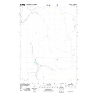
2011 Map of Elk Valley
USGS Topo · Published 2011About this map
Rock Creek and Crow Creek dominate this high-altitude landscape in Lincoln County, where the hydrological network of the Caribou-Targhee National Forest area is captured in precise detail. The terrain is defined by prominent landmarks such as The Pinnacle and Clover Knoll, alongside smaller drainages including Little Elk Creek and Robinson Creek. This 2011 survey reflects the modern management of these public lands, showing the established route of Caribou NF Rd 111 and Caribou NFD 147 as they thread through the drainages. Distinctive local names like Quakie Hollow and Driveway Creek provide a look at the vernacular geography of this western Wyoming borderland.
Find a feature on this map
24 named features on this map. Tap any name to fly to it.
Don’t see what you’re looking for? This feature index may not catch every label — zoom into the map to look around manually.
Map Details
Editions of this 2011 Elk Valley Map
This is the sole edition of this map. No revisions or reprints were ever made.
Other maps of this area

1909 · Montpelier
USGS Topo · 1:125,000

1911 · Montpelier
USGS Topo · 1:125,000

1915 · Crow Creek
USGS Topo · 1:62,500

1921 · Afton
USGS Topo · 1:125,000

1936 · Cokeville
USGS Topo · 1:96,000

1942 · Cokeville
USGS Topo · 1:125,000

1949 · Stewart Flat
USGS Topo · 1:24,000

1949 · Snowdrift Mountain
USGS Topo · 1:24,000

1951 · Stewart Flat
USGS Topo · 1:24,000
1951 · Snowdrift Mountain
USGS Topo · 1:24,000