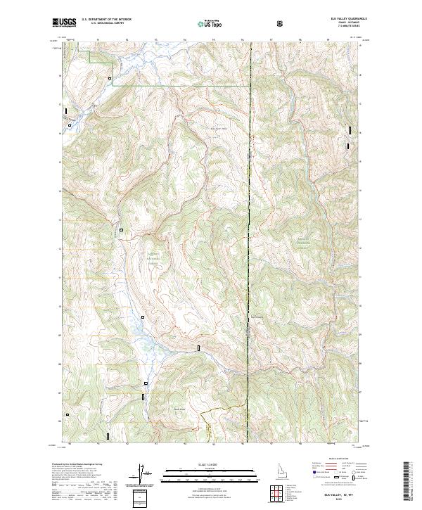
2023 Map of Elk Valley
USGS Topo · Published 2023About this map
The Caribou National Forest and Bridger National Forest meet along the dramatic border of Idaho and Wyoming, a landscape defined by the high ridges of the Webster Range and the Gannet Hills. This survey captures a network of historic backcountry routes and pack trails that facilitate movement through high-altitude terrain, including the State Line Trl and the Spring Creek Divide Trl. Local identifiers like Quakie Hollow and Camel Hollow point to the area's timber and drainage patterns, while the naming of The Pinnacle and Clover Knoll highlights the prominent landmarks used by early surveyors and travelers.
Find a feature on this map
50 named features on this map. Tap any name to fly to it.
Don’t see what you’re looking for? This feature index may not catch every label — zoom into the map to look around manually.
Map Details
Editions of this 2023 Elk Valley Map
This is the sole edition of this map. No revisions or reprints were ever made.
Other maps of this area

1909 · Montpelier
USGS Topo · 1:125,000

1911 · Montpelier
USGS Topo · 1:125,000

1915 · Crow Creek
USGS Topo · 1:62,500

1921 · Afton
USGS Topo · 1:125,000

1936 · Cokeville
USGS Topo · 1:96,000

1942 · Cokeville
USGS Topo · 1:125,000

1949 · Stewart Flat
USGS Topo · 1:24,000

1949 · Snowdrift Mountain
USGS Topo · 1:24,000

1951 · Stewart Flat
USGS Topo · 1:24,000
1951 · Snowdrift Mountain
USGS Topo · 1:24,000