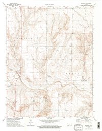
1974 Map of Elkader
USGS Topo · Published 1997About this map
Smoky Hill River winds through the high plains of Western Kansas, marking a landscape where water and geology define the human geography. Near the confluence of the river and Ladder Creek, the small settlement of Elkader sits as a lonely outpost amidst the expansive terrain. This 1970s survey highlights the striking geological features of the region, specifically the Chalk Pyramids and the Monument Rocks Natural Landmark, which rise abruptly from the surrounding plains.
Find a feature on this map
19 named features on this map. Tap any name to fly to it.
Don’t see what you’re looking for? This feature index may not catch every label — zoom into the map to look around manually.
Map Details
Editions of this 1974 Elkader Map
2 editions found

Other maps of this area

1939 · Lake Mc Bride
USGS Topo · 1:24,000

1939 · Sandon
USGS Topo · 1:62,500

1942 · Sandon
USGS Topo · 1:62,500

1942 · Lake Mc Bride
USGS Topo · 1:31,680

1955 · Scott City
USGS Topo · 1:250,000

1958 · Scott City
USGS Topo · 1:250,000

1972 · Elkader NW
USGS Topo · 1:24,000

1972 · Orion
USGS Topo · 1:24,000

1972 · Elkader NE
USGS Topo · 1:24,000

1974 · Healy NW
USGS Topo · 1:24,000