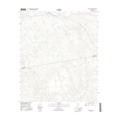
2016 Map of Elkhart Creek
USGS Topo · Published 2016About this map
Elkhart sits at the northern edge of this East Texas survey, where the rolling wooded terrain of the Piney Woods meets the headwaters of several significant drainage systems. The landscape is defined by the winding course of Elkhart Creek, which flows south toward the Anderson and Houston County line. This 2016 record of the area highlights the persistent rural character of the region, where numerous small watercourses like Box Creek and Ioni Creek carve through the countryside.
Find a feature on this map
58 named features on this map. Tap any name to fly to it.
Don’t see what you’re looking for? This feature index may not catch every label — zoom into the map to look around manually.
Map Details
Editions of this 2016 Elkhart Creek Map
This is the sole edition of this map. No revisions or reprints were ever made.
Other maps of this area

1951 · Grapeland
USGS Topo · 1:24,000

1951 · Elkhart
USGS Topo · 1:62,500

1952 · Slocum
USGS Topo · 1:62,500

1953 · Palestine
USGS Topo · 1:250,000

1957 · Palestine
USGS Topo · 1:250,000

1964 · Hays Spring
USGS Topo · 1:24,000

1964 · Stanmire Lake
USGS Topo · 1:24,000

1981 · Palestine
USGS Topo · 1:100,000
1982 · Indian Lake
USGS Topo · 1:24,000
1982 · Percilla
USGS Topo · 1:24,000