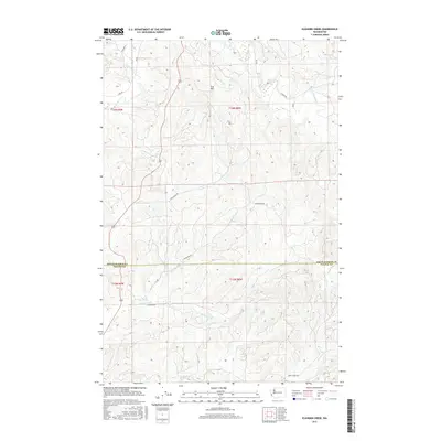
2017 Map of Elkhorn Creek
USGS Topo · Published 2017About this map
The North River meanders through the timberlands of southwest Washington, defining the drainage patterns of this corner of the state where Grays Harbor and Pacific counties meet. This coastal range landscape is deeply etched by a network of waterways including Elkhorn Creek and its tributary, the W Fork Elkhorn Cr, which flow through the southern portion of the quadrangle. The topography is characterized by rising timber slopes and named landmarks such as Scar Hill, with much of the human activity tied to the forest economy and the roads that service it.
Find a feature on this map
22 named features on this map. Tap any name to fly to it.
Don’t see what you’re looking for? This feature index may not catch every label — zoom into the map to look around manually.
Map Details
Editions of this 2017 Elkhorn Creek Map
This is the sole edition of this map. No revisions or reprints were ever made.
Other maps of this area

1938 · South Bend
USGS Topo · 1:62,500

1940 · Montesano
USGS Topo · 1:62,500

1940 · South Bend
USGS Topo · 1:62,500

1953 · Hoquiam
USGS Topo · 1:250,000

1955 · Montesano
USGS Topo · 1:62,500

1955 · Raymond
USGS Topo · 1:62,500

1955 · Aberdeen SE
USGS Topo · 1:24,000

1957 · Hoquiam
USGS Topo · 1:250,000
1957 · South Bend
USGS Topo · 1:24,000
1957 · South Bend
USGS Topo · 1:62,500