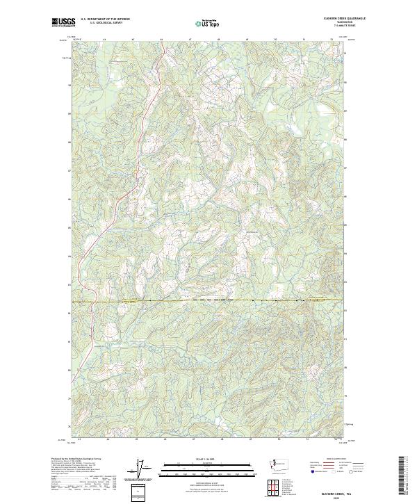
2023 Map of Elkhorn Creek
USGS Topo · Published 2023About this map
The North River winds through this heavily forested timberland corner of southwest Washington, marking the divide between Grays Harbor Co and Pacific Co. This modern topographic survey highlights a landscape defined by its drainage network and a network of logging and access routes like N River Rd and Spruce Dale Rd. The terrain is dominated by prominent elevations such as Scar Hill and dissected by numerous water bodies including Salmon Creek, Joe Creek, and the intricate headwaters of the West Fork Elkhorn Creek. A system of secondary roads and forest lines, such as C Line and Smith Creek Rd, provides evidence of the ongoing role of the timber industry in this Pacific Northwest backcountry. The map clearly delineates the township and range boundaries of t16n r8w and t15n r8w, offering a precise view of the local land use patterns at the edge of the coastal range.
Find a feature on this map
22 named features on this map. Tap any name to fly to it.
Don’t see what you’re looking for? This feature index may not catch every label — zoom into the map to look around manually.
Map Details
Editions of this 2023 Elkhorn Creek Map
This is the sole edition of this map. No revisions or reprints were ever made.
Other maps of this area

1938 · South Bend
USGS Topo · 1:62,500

1940 · Montesano
USGS Topo · 1:62,500

1940 · South Bend
USGS Topo · 1:62,500

1953 · Hoquiam
USGS Topo · 1:250,000

1955 · Montesano
USGS Topo · 1:62,500

1955 · Raymond
USGS Topo · 1:62,500

1955 · Aberdeen SE
USGS Topo · 1:24,000

1957 · Hoquiam
USGS Topo · 1:250,000
1957 · South Bend
USGS Topo · 1:24,000
1957 · South Bend
USGS Topo · 1:62,500