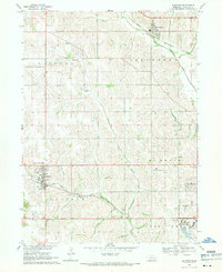
1968 Map of Elkhorn
USGS Topo · Published 1971About this map
Boys Town and the growing communities west of Omaha characterize this 1960s landscape, captured just as suburban expansion began to meet the established agricultural valleys of North Branch Papillion Creek and West Papillion Creek. The map documents a significant intersection of religious and educational institutions, including St Patricks Seminary and Sunny Side Sch, alongside essential public infrastructure like the County Hospital Annex.
Find a feature on this map
28 named features on this map. Tap any name to fly to it.
Don’t see what you’re looking for? This feature index may not catch every label — zoom into the map to look around manually.
Map Details
Editions of this 1968 Elkhorn Map
4 editions found
Other maps of this area

1893 · Fremont
USGS Topo · 1:125,000

1896 · Fremont
USGS Topo · 1:125,000

1955 · Fremont
USGS Topo · 1:250,000

1956 · Gretna
USGS Topo · 1:24,000

1956 · Ralston
USGS Topo · 1:24,000

1956 · Irvington
USGS Topo · 1:24,000

1957 · Fremont
USGS Topo · 1:250,000

1958 · Fremont
USGS Topo · 1:250,000

1968 · Valley
USGS Topo · 1:24,000

1968 · Kennard
USGS Topo · 1:24,000