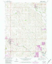
1968 Map of Elkhorn
USGS Topo · Published 1983About this map
Bennington and Elkhorn anchor this mid-century survey of the West Omaha periphery, capturing a landscape transitioning from rural prairie to suburban expansion. The prominent Boys Town campus sits in the southern portion of the sheet, while the U S Military Reservation occupies the northwest. The terrain is defined by the winding courses of Big Papillion Creek and West Papillion Creek, with several small country schools and churches like Sunny Side Sch and Zion Ch still standing as landmarks of earlier settlement. Local genealogy and history are well represented by the inclusion of Mount Calvary Cem and the Flower Hill Cem. A notable geographic feature is the presence of an Old Railroad Grade near Bennington, illustrating the shifting transportation priorities as modern highways began to define Douglas County.
Find a feature on this map
24 named features on this map. Tap any name to fly to it.
Don’t see what you’re looking for? This feature index may not catch every label — zoom into the map to look around manually.
Map Details
Editions of this 1968 Elkhorn Map
4 editions found
Other maps of this area

1893 · Fremont
USGS Topo · 1:125,000

1896 · Fremont
USGS Topo · 1:125,000

1955 · Fremont
USGS Topo · 1:250,000

1956 · Gretna
USGS Topo · 1:24,000

1956 · Ralston
USGS Topo · 1:24,000

1956 · Irvington
USGS Topo · 1:24,000

1957 · Fremont
USGS Topo · 1:250,000

1958 · Fremont
USGS Topo · 1:250,000

1968 · Valley
USGS Topo · 1:24,000

1968 · Kennard
USGS Topo · 1:24,000